Category:Maps of the Chilean War of Independence
Media in category "Maps of the Chilean War of Independence"
The following 11 files are in this category, out of 11 total.
-
 Asalto de Talcahuano (7 de diciembre de 1817).jpg 1,468 × 2,275; 1.25 MB
-
 Batalla del Cerro Gavilan - Independencia de Chile-2.jpg 849 × 638; 258 KB
-
 Batalla del Cerro Gavilan - Independencia de Chile.jpg 849 × 1,024; 631 KB
-
 Cochrane-Loreto-voyage.svg 94 × 419; 124 KB
-
 Costa americana del Pacifico.svg 95 × 419; 56 KB
-
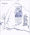 Croquis chilllan 1813.JPG 730 × 847; 259 KB
-
 FCNS1.svg 181 × 349; 1.26 MB
-
 Plano de batalla de Cancha Rayada (1818).jpg 1,573 × 2,183; 1.09 MB
-
 Ruta-aquiles.svg 1,230 × 666; 120 KB
-
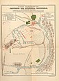
 Segunda Campaña del Sur 1.jpg 933 × 682; 233 KB
-
 Segunda Campaña del Sur 2.jpg 933 × 682; 236 KB
.jpg)


.jpg)


