Category:Maps of the Congo Free State
Media in category "Maps of the Congo Free State"
The following 59 files are in this category, out of 59 total.
-
 KONGO1877.JPG 6,137 × 5,393; 5.58 MB
-
 1884 Map of the Belgium Congo.jpg 1,000 × 836; 184 KB
-

-

-
 71 of 'Chez les Abarambos. Ce que devient l'Afrique mystérieuse, etc' (11236995843).jpg 2,272 × 1,454; 293 KB
-
 8 of 'De onafhankelijke Congostaat. Met eene kaart en 34 lichtteekeningen' (11250731263).jpg 2,512 × 2,995; 1.24 MB
-

-

-
 A Map of the route of the Emin Pasha Relief Expedition Wellcome L0034226.jpg 7,770 × 4,512; 17.79 MB
-

-
 Campagne arabe - Dhanis.jpg 1,484 × 937; 151 KB
-
 Campagne arabe - général.jpg 1,015 × 1,331; 202 KB
-
 Campagne arabe - préliminaire.jpg 955 × 1,144; 185 KB
-
 Campagne contre les révoltés de l'expédition Dhanis, 1897-1900.jpg 1,225 × 835; 144 KB
-
 Campagne contre les révoltés de l'expédition Dhanis.jpg 952 × 1,338; 178 KB
-
 Campagne contre les révoltés de Luluabourg.jpg 939 × 1,010; 132 KB
-
 Carte de l'Afrique politique en 1888 par E Banninfg pour le BCK - IMG 4379.jpg 3,888 × 5,184; 5.37 MB
-

-
 Carte du Congo belge... - btv1b531972816.jpg 8,212 × 9,308; 13.17 MB
-
 Circuit effectué par la commission.png 839 × 651; 70 KB
-
 Commission Anglo-Congolaise du 30ème. Méridien. (WOOS-14-10-2-1).jpg 6,442 × 7,313; 23.37 MB
-
 Commission Anglo-Congolaise du 30ème. Méridien. (WOOS-14-10-2-2).jpg 6,296 × 8,680; 28.01 MB
-
 Congo concessions.JPG 694 × 625; 425 KB
-
 Congostate00boul orig 0425 ergebnis.png 3,540 × 3,616; 12.88 MB
-
 EHC K134694 2021 0001-w2XgDPLBUNHhitOZoTFZ89Qg.jpg 6,684 × 5,276; 10.83 MB
-
 EIC - frontières 1885.jpg 1,634 × 1,038; 181 KB
-
 Etat des connaissances sur lAfrique en 1876.jpg 621 × 673; 58 KB
-
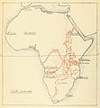
 Europe in Africa in the nineteenth century (1895) (14790566493).jpg 2,810 × 1,744; 585 KB
-
 Exploration Ubangi-Itimbiri.jpg 1,434 × 1,041; 188 KB
-
 Expédition Dhanis, 17-02-1897.jpg 518 × 904; 75 KB
-
 Expédition Van Kerckhoven.jpg 1,774 × 1,037; 209 KB
-
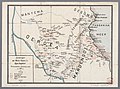
 Expéditions au Katanga.jpg 972 × 1,161; 158 KB
-
 Expéditions au nord du Bomu.jpg 926 × 1,358; 166 KB
-
 Expéditions du Kwango.jpg 1,178 × 940; 152 KB
-
 Force Publique 1888-1914.jpg 1,045 × 1,138; 140 KB
-
 Frontières orientales congo.jpg 917 × 1,446; 151 KB
-
 KONGO BELGIEN.png 526 × 524; 52 KB
-
 Kongovrijstaat.jpg 499 × 511; 164 KB
-
 Kuilu-Niadi - Banana - Bolobo.jpg 1,207 × 1,043; 141 KB
-
 Les campagnes mahdistes générale.jpg 848 × 1,193; 141 KB
-
 Les campagnes mahdistes.jpg 904 × 1,175; 164 KB
-
 Les expeditions de la Societe Internationale Africaine.png 835 × 646; 670 KB
-
 Les Explorateurs du Haut Congo LOEuvre de Stanley et de Hanssens.png 3,949 × 2,891; 6.8 MB
-
 Les Explorations du Kassai.png 877 × 625; 717 KB
-
 Les explorations du Sud et du Centre africains jusquen 1876.jpg 628 × 677; 45 KB
-
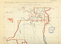
 Les Grandes Expéditions.jpg 1,042 × 1,411; 202 KB
-
 LocationCongoFreeState.png 1,357 × 628; 44 KB
-

-
 Loeuvrecivilisat00reni 0253.jpg 988 × 723; 101 KB
-
 Loeuvrecivilisat00reni 0341.jpg 988 × 720; 83 KB
-
 Loeuvrecivilisat00reni 0345 Angola.jpg 988 × 720; 88 KB
-

-
 Map of the Congo Territories—Under the personal rule of King Leopold II.jpg 4,367 × 4,050; 10.7 MB
-
 PMa B 471 Tervuren.jpg 600 × 382; 234 KB
-
 Révolte de Shinkakasa.jpg 1,151 × 752; 126 KB
-

-
 Sunprint Showing 30th Meridian & Proposed Boundary (1908) - War Office ledger (WOOS-14-11).jpg 3,671 × 8,739; 13.34 MB
-
 The American Museum journal (c1900-(1918)) (17973537689).jpg 1,900 × 2,644; 820 KB
-


.jpg)
.jpg)
.jpg)


.jpg)
.jpg)


_(14790566493).jpg)


_-_War_Office_ledger_(WOOS-14-11).jpg)
)_(17973537689).jpg)
