Category:Maps of the Cuban Missile Crisis
Media in category "Maps of the Cuban Missile Crisis"
The following 22 files are in this category, out of 22 total.
-
 1962 Cuba Missiles (30848755396).jpg 1,268 × 616; 394 KB
-
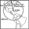 Amerikar.gif 322 × 320; 14 KB
-
 CubaMap1b w.jpg 593 × 512; 94 KB
-
 Cuban crisis map missile range.jpg 666 × 662; 198 KB
-
 CubaSites1962.jpg 760 × 627; 171 KB
-
 Estats Units - Crisi de Cuba (teatre american).png 568 × 510; 75 KB
-
 Fuerza de Tareas 137. 1962.jpg 953 × 960; 92 KB
-
-

-

-

-
 MRBM Field Launch Site San Cristobal No. 1 14 October 1962 - NARA - 193926.tif 3,000 × 2,532; 7.24 MB
-
 MRBM Field Launch Site San Cristobal No. 2 14 October 1962 - NARA - 193927.tif 3,000 × 2,524; 7.22 MB
-
 MRBM Launch Site 1 Sagua La Grande 1 November 1962 - NARA - 193932.tif 3,000 × 2,532; 7.24 MB
-
 MRBM Launch Site 1 San Cristobal, Cuba 25 October 1962 - NARA - 193928.tif 3,000 × 2,531; 7.24 MB
-
 MRBM Launch Site 1, 25 October 1962.jpg 760 × 623; 420 KB
-
 MRBM Launch Site 3 San Cristobal Cuba 27 January 1963 - NARA - 193935.tif 3,000 × 2,522; 7.22 MB
-
 MRBM Launch Site 3 San Cristobal, Cuba 27 October 1962 - NARA - 193931.tif 3,000 × 2,534; 7.25 MB
-
 Reconnaissance objectives in Cuba, 1962.JPG 1,800 × 1,292; 302 KB
-
 SA-2 Launch sites in Cuba.jpg 3,212 × 2,536; 2.99 MB
-
 Soviet Forces on Cuba (October 22, 1962).GIF 540 × 411; 16 KB
-
 The relative ranges of the IL-28, SS-4, and SS-5, stationed on Cuba.png 843 × 730; 182 KB
.jpg)


.png)


.jpg)


.GIF)
