Category:Maps of the Dead Sea
Subcategories
This category has the following 2 subcategories, out of 2 total.
M
- Mediterranean–Dead Sea Canal (3 F)
O
- Old maps of the Dead Sea (13 F)
Media in category "Maps of the Dead Sea"
The following 27 files are in this category, out of 27 total.
-
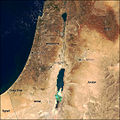 Modis near east.jpg 540 × 540; 80 KB
-
 Butler Palestina 2 G.jpg 307 × 789; 98 KB
-
 Butler Palestina D.jpg 303 × 722; 87 KB
-
 Dead sea ecological disaster 1960 - 2007 arabic.gif 244 × 406; 226 KB
-
 Dead sea ecological disaster 1960 - 2007.gif 244 × 406; 254 KB
-
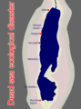 Dead sea ecological disaster.gif 458 × 620; 759 KB
-
 Dead sea german.jpg 292 × 481; 68 KB
-
 Dead Sea in its region (-mini map -rivers) (zoom + special marker).svg 992 × 558; 1.18 MB
-
 Dead sea map 1960.png 244 × 406; 17 KB
-
 Dead Sea new salt.jpg 2,050 × 1,405; 1.46 MB
-
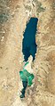 Dead sea.jpg 2,028 × 3,885; 2.98 MB
-
 Dead Sea.svg 300 × 300; 5 KB
-
 Dead-sea satellite 2019-07 Nord-Sud.jpg 2,537 × 3,788; 3.53 MB
-
 DeadSeaEnGdi1949.jpg 826 × 1,253; 192 KB
-
 ETH-BIB-Totes Meer und St. Galler Rheintal-Dia 247-Z-00203.tif 3,650 × 2,938; 30.83 MB
-
 Itsaso Hila.png 727 × 1,143; 1.17 MB
-
 John Bartholomew & Co., Section VIII - Moab & Dead Sea (FL46962189 3907205).jpg 3,831 × 4,850; 14.95 MB
-
 JordanRiver en.svg 1,016 × 1,285; 809 KB
-
 JordanRiver it.svg 1,016 × 1,285; 872 KB
-
 JordanRiver-ar.png 474 × 599; 60 KB
-
 Laguna Sedom.svg 100 × 169; 52 KB
-
 Lisan.svg 550 × 1,014; 14 KB
-
 Map of the River Jordan and Dead Sea by W. F. Lynch.png 1,024 × 1,954; 2.98 MB
-
 Mapa Morza Mmartwe.jpg 2,480 × 3,508; 1.36 MB
-
 Mappa Popoli del mare Levante.svg 810 × 1,212; 709 KB
-
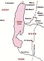 Moabite territory map 1.jpg 297 × 409; 25 KB
-
 The Dead Sea and Surroundings EL.png 564 × 774; 41 KB


_(zoom_%2B_special_marker).svg)


.jpg)


