Category:Maps of the Deepwater Horizon oil spill
Media in category "Maps of the Deepwater Horizon oil spill"
The following 37 files are in this category, out of 37 total.
-
 1884 cumlative4 29 trajectories.jpg 1,683 × 1,275; 199 KB
-
 BP OilSpill FisheryClosureMap 062110.pdf 1,625 × 1,281; 783 KB
-
 Deepwater Horizon incident, Gulf of Mexico LOC 2010589205.jpg 10,800 × 7,200; 6.15 MB
-
 Deepwater Horizon incident, Gulf of Mexico LOC 2010589205.tif 10,800 × 7,200; 222.47 MB
-
-
 Deepwater Horizon incident, Gulf of Mexico, forecasted oil spill location for May 1, 2010 LOC 2010589162.tif 13,200 × 10,800; 407.87 MB
-
 Deepwater Horizon Oil Spill Fishing Closure 2010-05-25.png 3,254 × 2,566; 288 KB
-
 Deepwater Horizon oil spill fishing closure map 2010-06-02.png 3,254 × 2,566; 314 KB
-
 Deepwater Horizon oil spill fishing closure map 2010-06-21.png 3,254 × 2,566; 306 KB
-
 Deepwater Horizon oil spill NOAA map.jpg 962 × 747; 370 KB
-
 DeepwaterHorizonOilSpill FishingClosure 2010-05-18.png 3,226 × 2,538; 251 KB
-
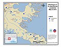
 EPA Air Monitoring Locations April 28 - May 14, 2010 (4612958117).jpg 3,300 × 2,550; 2.04 MB
-
 EPA Air Monitoring Locations May 10, 2010 (4612082200).jpg 3,300 × 2,550; 1.8 MB
-
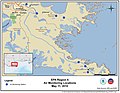
 EPA Air Monitoring Locations May 11, 2010 (4611472203).jpg 3,300 × 2,550; 1.8 MB
-
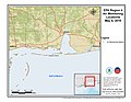
 EPA Air Monitoring Locations May 11, 2010 (4612083038).jpg 3,300 × 2,550; 2.04 MB
-
 EPA Air Monitoring Locations May 12, 2010 (4612083598).jpg 3,300 × 2,550; 1.63 MB
-
 EPA Air Monitoring Locations May 13, 2010 (4612083850).jpg 3,300 × 2,550; 1.78 MB
-
 EPA Air Monitoring Locations May 13-14, 2010 (4611473283).jpg 3,300 × 2,550; 2.02 MB
-
 EPA Air Monitoring Locations May 4, 2010 (4611469093).jpg 3,300 × 2,550; 1.43 MB
-
 EPA Air Monitoring Locations May 4, 2010 (4611469787).jpg 3,300 × 2,550; 1.46 MB
-
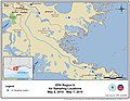
 EPA Air Monitoring Locations May 5, 2010 (4612080288).jpg 3,300 × 2,550; 1.44 MB
-
 EPA Air Monitoring Locations May 6, 2010 (4611469357).jpg 3,300 × 2,550; 1.8 MB
-
 EPA Air Monitoring Locations May 7, 2010 (4611469521).jpg 3,300 × 2,550; 1.49 MB
-
 EPA Air Monitoring Locations May 7, 2010 (4612080512).jpg 3,300 × 2,550; 1.45 MB
-
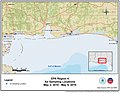
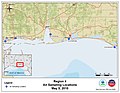
 EPA Air Monitoring Locations May 9, 2010 (4611470407).jpg 3,300 × 2,550; 1.63 MB
-
 EPA Air Monitoring Locations May 9, 2010 (4611470671).jpg 3,300 × 2,550; 1.92 MB
-
 EPA Air Sampling Locations May 1, 2010 (4612081156).jpg 3,300 × 2,550; 1.96 MB
-
 EPA Air Sampling Locations May 1-2, 2010 (4612081278).jpg 3,300 × 2,550; 1.94 MB
-
 EPA Air Sampling Locations May 2, 2010 (4612081362).jpg 3,300 × 2,550; 1.82 MB
-
 EPA Air Sampling Locations May 3-4, 2010 (4611472727).jpg 3,300 × 2,550; 2.23 MB
-
 EPA Air Sampling Locations May 4-5, 2010 (4611470325).jpg 3,300 × 2,550; 1.96 MB
-
 EPA Air Sampling Locations May 4-7, 2010 (4612083214).jpg 3,300 × 2,550; 2.05 MB
-
 EPA Air Sampling Locations May 5, 2010 (4612084278).jpg 3,300 × 2,550; 2.25 MB
-
 EPA Air Sampling Locations May 6-8, 2010 (4612957763).jpg 3,300 × 2,550; 2.47 MB
-
 EPA Air Sampling Locations May 8-10, 2010 (4611473093).jpg 3,300 × 2,550; 2.84 MB
-
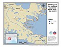
 EPA Water Sampling Locations May 1-3, 2010 (4612081608).jpg 3,300 × 2,550; 2.01 MB
-
 Noaa-projection-deepwater.png 528 × 408; 63 KB


.jpg)
.jpg)
.jpg)
.jpg)
.jpg)
.jpg)
.jpg)
.jpg)
.jpg)
.jpg)
.jpg)
.jpg)
.jpg)
.jpg)
.jpg)
.jpg)
.jpg)
.jpg)
.jpg)
.jpg)
.jpg)
.jpg)
.jpg)
.jpg)
.jpg)
