Category:Maps of the Elbe in Czechia
Media in category "Maps of the Elbe in Czechia"
The following 10 files are in this category, out of 10 total.
-
 Elbe Einzugsgebiet.png 1,309 × 1,381; 1.96 MB
-
 Brandýs nad Labem, Ostrůvek.png 578 × 579; 420 KB
-
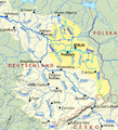
 Elbe basin.png 1,309 × 1,381; 1.8 MB
-
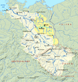
 Spree-Havel in Elbe basin, cut.png 787 × 863; 723 KB
-
 Spree-Havel in Elbe basin.png 1,309 × 1,381; 1.79 MB
-
 Elbe tributaries discharge diagram mk.svg 1,600 × 1,200; 440 KB
-
 Karel Škréta ml. Mapa Čech (1679).png 800 × 775; 1.35 MB
-

-
 Rozcestník Děčín-Tyršův most.jpg 2,448 × 3,264; 1.65 MB
-
 Elbe tributaries discharge diagram.svg 1,600 × 1,200; 23 KB


.png)


