Category:Maps of the Enceinte de Thiers
Media in category "Maps of the Enceinte de Thiers"
The following 13 files are in this category, out of 13 total.
-
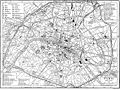 Britannica Paris.jpg 1,173 × 877; 371 KB
-
 Britannica Paris.png 2,927 × 2,172; 536 KB
-
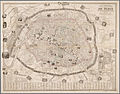 Bénard, Nouveau plan illustré de la ville de Paris, 1857.jpg 4,364 × 3,436; 3.37 MB
-
 Henri Dron & Heymann, Plan de la Commune de Paris - Paris Musées.jpg 7,790 × 6,029; 29.14 MB
-
 Illustrirte Zeitung (1843) 15 229 1 Plan der Befestigung von Paris.PNG 1,504 × 1,194; 847 KB
-
 LPDF 16 8 carte de la défense de Paris.jpg 478 × 483; 196 KB
-
 Paris PC 1859 jms.jpg 5,820 × 4,968; 6.28 MB
-
 Plan des anciennes enceintes de Paris (1180-1845) - Paris Musées.jpg 9,262 × 6,876; 40.55 MB
-

-
 Plan des anciennes enceintes et limites de Paris, Etabli par A. Grimault (02) - Paris Musées.jpg 8,463 × 6,108; 31.94 MB
-
 Plan des anciennes enceintes et limites de Paris, Etabli par A. Grimault (03) - Paris Musées.jpg 8,216 × 6,152; 32.71 MB
-
 The city limits of Paris from the 4th century to 2015.svg 1,500 × 1,000; 24 KB
-
 Tracé rue d'Enfer en 1857.jpg 521 × 609; 108 KB


_15_229_1_Plan_der_Befestigung_von_Paris.PNG)


_-_Paris_Mus%C3%A9es.jpg)
_-_Paris_Mus%C3%A9es.jpg)
_-_Paris_Mus%C3%A9es.jpg)
_-_Paris_Mus%C3%A9es.jpg)

