Category:Maps of the Erie Canal
Pages in category "Maps of the Erie Canal"
The following 3 pages are in this category, out of 3 total.
Media in category "Maps of the Erie Canal"
The following 25 files are in this category, out of 25 total.
-

-
 1832 Erie Canal.jpg 4,205 × 938; 774 KB
-

-

-

-
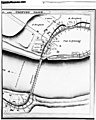 Aqueduct at Rexford, New York.jpg 548 × 684; 171 KB
-
 Buffalo, Double Page Plate No. 20 (Map bounded by Porter Ave., Niagara River, Ferry St.) NYPL2055436.tiff 7,102 × 5,327, 2 pages; 108.5 MB
-
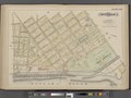
 Buffalo-1905.jpg 989 × 586; 279 KB
-

-

-

-
-

-
 Erie Canal Map 1853.jpg 782 × 426; 217 KB
-
 Erie Canal, New York) - Hooker. NYPL1030042.tiff 4,896 × 5,267; 73.78 MB
-
 Erie Welland Canals-1850.tif 2,771 × 1,709; 4.54 MB
-
 Erie-Canal 150 years 1967.jpg 3,941 × 2,168; 1.52 MB
-
 Erie-canal 1840 map.jpg 819 × 355; 312 KB
-
 ErieCanalMap.jpg 1,800 × 750; 619 KB
-
-
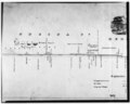
 Map and profile of the Erie Canal, 1834.jpg 2,401 × 1,638; 1.26 MB
-
 Niagara and Onondoga escarpments, 1825.jpg 567 × 360; 115 KB
-
-
 Water Level Route on US map cropped.png 675 × 466; 176 KB
-
 Water Level Route on US map.png 5,912 × 4,003; 1.88 MB


