Category:Maps of the European Economic Area

Media in category "Maps of the European Economic Area"
The following 20 files are in this category, out of 20 total.
-
 Agreement on the European Economic Area.svg 610 × 610; 472 KB
-
 EEA CES.PNG 1,464 × 464; 43 KB
-
 EEA single entity.PNG 432 × 426; 5 KB
-
 EEA-2019.svg 460 × 460; 647 KB
-
 EEA.PNG 450 × 422; 18 KB
-
 EEA.svg 680 × 520; 528 KB
-
 Eee members.PNG 1,001 × 554; 82 KB
-
 EES.svg 610 × 610; 342 KB
-
 European Economic Area Agreement.svg 655 × 690; 261 KB
-
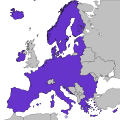
 European Economic Area and Switzerland.svg 610 × 610; 472 KB
-
 European Economic Area Map.svg 610 × 610; 800 KB
-
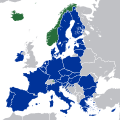 European Economic Area member states.svg 1,300 × 1,300; 446 KB
-
 European Economic Area members.svg 1,300 × 1,300; 7.36 MB
-
 European Economic Area.svg 2,045 × 1,720; 7.33 MB
-
 European Spaces Map (no legend).svg 645 × 610; 524 KB
-
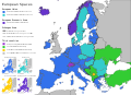 European Spaces Map.svg 845 × 610; 2.91 MB
-
 European Spaces.png 3,507 × 2,481; 4.4 MB
-
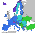
 European Spaces.svg 680 × 520; 598 KB
-
 Europäische Zollunion und Partnerstaaten.svg 680 × 520; 419 KB
-
 Progetto Ægea - AEgea Project - FIAT EMEA CAR.jpg 1,534 × 1,132; 513 KB


.svg)


