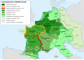
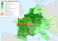
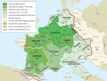
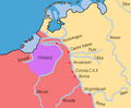
Category:Maps of the Frankish territory
- Maps are also available as part of the
 Wikimedia Atlas of the World project in the Atlas of the Frankish Empire.
Use the appropriate category for maps showing all or a large part of France. See subcategories for smaller areas:
| If the map shows | Category to use |
|---|---|
| France on a recently created map | Category:Maps of France or its subcategories |
| France on a map created more than 70 years ago | Category:Old maps of France or its subcategories |
| the history of France on a recently created map | Category:Maps of the history of France or its subcategories |
| the history of France on a map created more than 70 years ago | Category:Old maps of the history of France or its subcategories |
Subcategories
This category has the following 9 subcategories, out of 9 total.
A
- Maps of Austrasia (17 F)
B
- Maps of the history of Burgundy (73 F)
C
M
- Maps of the Duchy of Saxony (9 F)
N
- Maps of Neustria (3 F)
O
V
Pages in category "Maps of the Frankish territory"
The following 2 pages are in this category, out of 2 total.
Media in category "Maps of the Frankish territory"
The following 200 files are in this category, out of 235 total.
(previous page) (next page)-
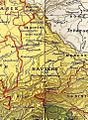
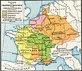
 Austrasie752.jpg 484 × 689; 78 KB
-
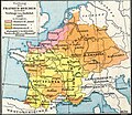
 Neustrie752.jpg 590 × 655; 89 KB
-
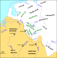
 LERP(1892) Karte zur Verbreitung der Hermunduren und Alt-Thüringer.jpg 3,136 × 3,943; 7.43 MB
-
 737 CE, Europe.svg 512 × 438; 1.62 MB
-
 771 CE, Europe.svg 512 × 438; 1.62 MB
-
 925 CE, Europe.svg 512 × 438; 1.7 MB
-
 A Short History of the World, p0268.jpg 1,162 × 1,087; 295 KB
-
 Abasside-empire-vers-820-es.svg 2,471 × 1,402; 334 KB
-
 AltaYBajaBorgoñaSiglosIXX.svg 1,002 × 1,014; 1.17 MB
-
 Beieren in de Frankische tijd.jpg 705 × 963; 252 KB
-
 Carte des peuples francs (IIIe siècle) hu.svg 1,704 × 1,751; 66 KB
-
 Carte des peuples francs (IIIe siècle) nl.svg 1,704 × 1,751; 331 KB
-
 Carte des peuples francs (IIIe siècle)-pt.svg 1,704 × 1,751; 63 KB
-
 Carte des peuples francs (IIIe siècle).svg 1,704 × 1,751; 473 KB
-
 Central Europe 5th Century.jpg 1,088 × 763; 457 KB
-
 Central Europe 5th Century.resize-ratio-1-1.jpg 763 × 763; 291 KB
-
 Central Europe at the time of the Carolingians (Putzger).jpg 3,476 × 2,814; 4.77 MB
-
 Central Europe in Carolingian times.jpg 3,234 × 2,865; 2.38 MB
-
 Central Europe in the late ninth century.png 511 × 289; 195 KB
-
 Chlodwigs Eroberungen.png 1,227 × 1,078; 2.78 MB
-
 Conquests of Clovis.png 1,220 × 1,079; 1.68 MB
-
 Conquêtes de Clodion.png 1,395 × 1,056; 454 KB
-
 Dagobert Austrien.jpg 1,074 × 818; 274 KB
-
 Das Frankenreich von 771–843.jpg 3,669 × 3,065; 2 MB
-
 Das Frankenreich von 771–843Simplificado-es.svg 3,265 × 2,679; 1.26 MB
-
 De Franken tussen 400 en 440 jp.svg 2,323 × 1,729; 660 KB
-
 De Franken tussen 400 en 440 nl.svg 2,323 × 1,729; 644 KB
-
 Deilig vom Frankeriich-511 als.PNG 1,250 × 1,157; 154 KB
-
 Deilig vom Frankeriich-628.png 1,250 × 1,157; 156 KB
-
 Die Reiche der Franken in Gallien unter den Merovingern (Spruner, 1854).jpg 6,627 × 5,176; 6.63 MB
-
 Die Reiche der Karolinger (Spruner, 1854).jpg 6,361 × 5,266; 6.16 MB
-
 Droysens-20.jpg 8,825 × 5,750; 3.92 MB
-
 Droysens-20a.jpg 6,385 × 5,423; 3.9 MB
-
 Droysens-20b.jpg 2,082 × 1,828; 3.15 MB
-
 Droysens-20c.jpg 2,104 × 1,820; 3.36 MB
-
 Droysens-20d.jpg 2,103 × 1,819; 3.45 MB
-
 Droysens-21.jpg 8,816 × 5,775; 4.05 MB
-
 Droysens-21a.jpg 6,520 × 5,772; 3.9 MB
-
 Droysens-21b.jpg 2,128 × 2,752; 3.91 MB
-
 Droysens-21c.jpg 2,152 × 2,764; 4.16 MB
-
 Empire de Charlemagne.jpg 9,384 × 6,880; 11.13 MB
-
 Europa zur Zeit Karls des Grossen (Spruner-Menke, map 3).jpg 3,292 × 2,750; 2.11 MB
-
 Europe in 814AD.png 1,218 × 888; 115 KB
-
 Europe in 900 AD.png 2,830 × 2,480; 1.56 MB
-
 Europe in the time of Charlemagne.jpg 4,938 × 4,125; 3.34 MB
-
 Europe in the time of Charles the Great.jpg 4,086 × 3,021; 3.1 MB
-
 Europe-600.jpg 729 × 1,005; 426 KB
-
 Europe-In-555AD.png 2,862 × 1,670; 2.85 MB
-
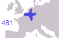
 Expansion of the Frankish empire 481-555.png 1,205 × 1,010; 2.67 MB
-
 Francia 714.png 1,252 × 1,240; 520 KB
-
 Frank exp 730-890.gif 792 × 507; 225 KB
-
 Franken Expans1.jpg 1,009 × 868; 250 KB
-
 Franken Expansion bis 6Jhdt.png 2,102 × 1,674; 856 KB
-
 Franken-um-800.jpg 1,344 × 1,280; 1.02 MB
-
 Frankenreich 768-811 als.PNG 1,400 × 1,180; 1 MB
-
 Frankenreich 768-811.jpg 1,400 × 1,180; 261 KB
-
 Frankenreich Expansion 481-555.png 1,141 × 999; 2.5 MB
-
 Frankenreich unter den Merowingern.jpg 3,287 × 2,874; 2 MB
-
 Frankenrijk.jpg 1,400 × 1,180; 179 KB
-
 Frankerriket 481 til 814-nor.svg 1,421 × 1,077; 594 KB
-
 Frankischetalen.png 498 × 427; 63 KB
-
 Frankish Empire (orthographic projection).svg 551 × 550; 735 KB
-
 Frankish Empire 481 to 814-af.svg 1,735 × 1,227; 331 KB
-
 Frankish Empire 481 to 814-als.svg 1,735 × 1,227; 331 KB
-
 Frankish Empire 481 to 814-ar.png 1,590 × 1,192; 445 KB
-
 Frankish Empire 481 to 814-ar.svg 1,591 × 1,205; 1.71 MB
-
 Frankish Empire 481 to 814-be.svg 1,735 × 1,227; 332 KB
-
 Frankish Empire 481 to 814-blank.svg 1,735 × 1,227; 251 KB
-
 Frankish Empire 481 to 814-ca.svg 1,735 × 1,227; 316 KB
-
 Frankish Empire 481 to 814-ce.svg 1,851 × 1,309; 299 KB
-
 Frankish Empire 481 to 814-de.svg 1,735 × 1,227; 332 KB
-
 Frankish Empire 481 to 814-el.png 792 × 600; 150 KB
-
 Frankish Empire 481 to 814-en.svg 1,591 × 1,205; 834 KB
-
 Frankish Empire 481 to 814-es.svg 1,851 × 1,309; 1.08 MB
-
 Frankish Empire 481 to 814-eu.svg 1,735 × 1,227; 325 KB
-
 Frankish Empire 481 to 814-fi.svg 1,735 × 1,227; 332 KB
-
 Frankish Empire 481 to 814-fr.png 2,087 × 1,476; 559 KB
-
 Frankish Empire 481 to 814-fr.svg 1,739 × 1,233; 296 KB
-
 Frankish Empire 481 to 814-hun.svg 1,851 × 1,309; 359 KB
-
 Frankish Empire 481 to 814-id.svg 1,735 × 1,227; 332 KB
-
 Frankish Empire 481 to 814-it.svg 1,735 × 1,227; 331 KB
-
 Frankish Empire 481 to 814-mk.svg 1,735 × 1,227; 1.13 MB
-
 Frankish Empire 481 to 814-nl 2.svg 1,735 × 1,227; 332 KB
-
 Frankish Empire 481 to 814-nl.svg 1,735 × 1,227; 328 KB
-
 Frankish Empire 481 to 814-NO.svg 1,052 × 797; 334 KB
-
 Frankish Empire 481 to 814-pl.svg 1,735 × 1,227; 314 KB
-
 Frankish Empire 481 to 814-pt.svg 1,735 × 1,227; 314 KB
-
 Frankish Empire 481 to 814-ru.svg 1,851 × 1,309; 285 KB
-
 Frankish Empire 481 to 814-sr.svg 1,735 × 1,227; 332 KB
-
 Frankish Empire 481 to 814-tr.svg 1,735 × 1,227; 329 KB
-
 Frankish Empire 481 to 814-uk.svg 1,591 × 1,205; 629 KB
-
 Frankish Empire 481 to 814-zh-hans.svg 1,739 × 1,233; 294 KB
-
 Frankish empire 768 - 814 and bavaria.png 1,735 × 1,343; 580 KB
-
 Frankish Empire 768 to 814-it.svg 1,735 × 1,343; 274 KB
-
 Frankish Empire Post-Charlemagne.png 1,113 × 678; 225 KB
-
 Frankish Foederatus.png 570 × 471; 73 KB
-
 Frankish Kingdom under the Merovingians.jpg 4,358 × 2,874; 2.84 MB
-
 Franks expansion.gif 790 × 505; 64 KB
-
 Frisia 600-734-mk.svg 338 × 349; 117 KB
-
 Frisia 716-es.svg 622 × 642; 174 KB
-
 Frisia 716-la.svg 583 × 602; 197 KB
-
 Frisia 716-ru.svg 622 × 642; 67 KB
-
 Gaul IVth century AD de.svg 972 × 780; 881 KB
-
 Gaul IVth century AD-es.svg 512 × 411; 828 KB
-
 Gaul IVth century AD-pt.svg 512 × 411; 200 KB
-
 Gaul IVth century AD.svg 972 × 780; 1.21 MB
-
 Great Moravia Puspoki's Theory.jpg 1,068 × 848; 960 KB
-
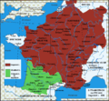
 Growth of the Frankish kingdoms (Putzger).jpg 1,614 × 1,583; 982 KB
-
 History of France-1.jpg 671 × 1,085; 99 KB
-

-

-

-

-

-
 Imperium Caroli Magni Occidentis Imperatoris (Vaugondy, 1752).jpg 6,892 × 5,995; 7.06 MB
-
 Imperium Caroli Magni Occidentis Imperatoris (Zatta, 1785).jpg 9,290 × 7,096; 6.95 MB
-
 Imperium Caroli Magni.jpg 7,178 × 6,242; 10.16 MB
-
 Karte Hoch Niederburgund-FR.png 2,000 × 2,126; 549 KB
-
 Karte Hoch und Niederburgund EN.png 2,000 × 2,126; 538 KB
-
 Karte Hoch und Niederburgund-el.png 1,310 × 1,338; 200 KB
-
 Karte Hoch- und Niederburgund.png 2,000 × 2,126; 549 KB
-
 La fuite de Radegonde-es.svg 1,344 × 1,550; 195 KB
-
 Le royaume Burgonde au Ve siècle la.svg 339 × 440; 122 KB
-
 Le royaume Burgonde au Ve siècle-es.svg 339 × 440; 126 KB
-
 Le royaume Burgonde au Ve siècle.png 339 × 440; 92 KB
-
 Le royaume Burgonde au Ve siècle.svg 339 × 440; 144 KB
-
 Les Francs en Belgique romaine-de.svg 1,280 × 883; 553 KB
-
 Les Francs en Belgique romaine-es.svg 1,280 × 883; 382 KB
-
 Les Francs en Belgique romaine-pt.svg 1,280 × 883; 35 KB
-
 Les Francs en Belgique romaine-ru.svg 1,280 × 883; 62 KB
-
 Les Francs en Belgique romaine.svg 1,280 × 883; 353 KB
-
 Les Francs entre 400 et 440-es.svg 2,323 × 1,729; 355 KB
-
 Les Francs entre 400 et 440-pt.svg 2,323 × 1,729; 62 KB
-
 Les Francs entre 400 et 440.svg 2,323 × 1,729; 430 KB
-
 Les Royaumes Francs en 450.jpg 2,929 × 2,541; 934 KB
-
 Les Royaumes Francs en 511.jpg 2,929 × 2,541; 1.09 MB
-
 Les Royaumes Francs en 534.jpg 2,929 × 2,541; 1.08 MB
-
 Les Royaumes Francs en 536.jpg 2,929 × 2,541; 1.06 MB
-
 Les Royaumes Francs en 555.jpg 2,929 × 2,541; 1.09 MB
-
 Les Royaumes Francs en 558.jpg 2,929 × 2,541; 1.08 MB
-
 Les Royaumes Francs en 561.jpg 2,929 × 2,541; 1.07 MB
-
 Les Royaumes Francs en 567.jpg 2,929 × 2,541; 1.09 MB
-
 Les Royaumes Francs en 577.jpg 2,929 × 2,541; 1.08 MB
-
 Les Royaumes Francs en 581.jpg 2,929 × 2,541; 1.08 MB
-
 Les Royaumes Francs en 584.jpg 2,929 × 2,541; 1.07 MB
-
 Les Royaumes Francs en 587.jpg 2,929 × 2,541; 1.1 MB
-
 Les Royaumes Francs en 592.jpg 2,929 × 2,541; 1.09 MB
-
 Les Royaumes Francs en 596.jpg 2,929 × 2,541; 1.09 MB
-
 Les Royaumes Francs en 600.jpg 2,929 × 2,541; 1.09 MB
-
 Les Royaumes Francs en 612.jpg 2,929 × 2,541; 1.1 MB
-
 Les Royaumes Francs en 628.jpg 2,929 × 2,541; 737 KB
-
 Les Royaumes Francs en 741.jpg 2,929 × 2,541; 1.26 MB
-
 Les Royaumes Francs en 771.jpg 2,929 × 2,541; 1.26 MB
-
 Les Royaumes Francs en 796.jpg 3,507 × 2,480; 1.33 MB
-
 Les Royaumes Francs en 817-820.jpg 3,507 × 2,480; 1.38 MB
-
 Les Royaumes Francs en 843.jpg 3,507 × 2,480; 1.43 MB
-
 Les Royaumes Francs en 853.jpg 3,507 × 2,480; 1.42 MB
-
 Les Royaumes Francs en 855.jpg 3,507 × 2,480; 1.42 MB
-
 Les Royaumes Francs en 863.jpg 3,507 × 2,480; 1.42 MB
-
 Les Royaumes Francs en 866.jpg 3,507 × 2,480; 1.42 MB
-
 Les Royaumes Francs en 868.jpg 3,507 × 2,480; 1.42 MB
-
 Les Royaumes Francs en 870.jpg 3,507 × 2,480; 1.42 MB
-
 Les Royaumes Francs en 875.jpg 3,507 × 2,480; 1.42 MB
-
 Les Royaumes Francs en 876.jpg 3,507 × 2,480; 1.42 MB
-
 Les Royaumes Francs en 877.jpg 3,507 × 2,480; 1.42 MB
-
 Les Royaumes Francs en 879.jpg 3,507 × 2,480; 1.42 MB
-
 Les Royaumes Francs en 880.jpg 3,507 × 2,480; 1.41 MB
-
 Les Royaumes Francs en 882.jpg 3,507 × 2,480; 1.41 MB
-
 Les Royaumes Francs en 884.jpg 3,507 × 2,480; 1.41 MB
-
 Les Royaumes Francs en 886.jpg 3,507 × 2,480; 1.42 MB
-
 Les Royaumes Francs en 887.jpg 3,507 × 2,480; 1.42 MB
-
 Les Royaumes Francs en 888.jpg 3,507 × 2,480; 1.41 MB
-
 Les Royaumes Francs en 895.jpg 3,507 × 2,480; 1.41 MB
-
 Les Royaumes Francs en 896.jpg 3,507 × 2,480; 1.42 MB
-
 Les Royaumes Francs en 899.jpg 3,507 × 2,480; 1.41 MB
-
 Les Royaumes Francs en 900.jpg 3,507 × 2,480; 1.4 MB
-
 MajorianEmpire.png 1,220 × 1,385; 1.51 MB
-
 Map Clovis and Theoderic.png 1,129 × 984; 613 KB
-
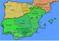
 Map Iberian Peninsula 1000-be.svg 827 × 574; 236 KB
-
 Map Iberian Peninsula 1000-de.svg 827 × 574; 243 KB
-
 Map Iberian Peninsula 1000-es.svg 827 × 574; 243 KB
-
 Map Iberian Peninsula 1000-hu.svg 827 × 574; 240 KB
-
 Map Iberian Peninsula 1000-ru.svg 827 × 574; 237 KB
-
 Map Iberian Peninsula 1030-ast.svg 827 × 574; 260 KB
-
 Map Iberian Peninsula 1030-es.svg 827 × 574; 280 KB
-
 Map Iberian Peninsula 1037-bg.svg 827 × 574; 253 KB
-
 Map Iberian Peninsula 1037-es.svg 827 × 574; 252 KB
-
 Map Iberian Peninsula 1037-pt.svg 512 × 355; 101 KB
-
 Map Iberian Peninsula 910-es.svg 818 × 569; 622 KB
-
 Map Iberian Peninsula 910-hu.svg 818 × 569; 573 KB
-
 Mapa de la Península Ibérica nel añu 1000.svg 827 × 574; 236 KB
-
 Mitteleuropa zur Zeit der Karolinger.jpg 4,301 × 2,842; 3.12 MB
-
 Partage de l'Empire carolingien au Traité de Verdun en 843.JPG 3,597 × 3,308; 3.66 MB
-
 Piemont Carolingian Empire map 1895.jpg 979 × 908; 991 KB
-
 Reino Burgúndio no século V.svg 339 × 440; 127 KB
-
 Roman Empire 460 CE-de.svg 1,220 × 1,385; 2.49 MB
-
 Roman Empire 460 CE-es.svg 1,220 × 1,385; 2.8 MB
-
 Roman Empire 460 CE-hu.svg 1,220 × 1,385; 2.47 MB
-
 Roman Empire 460 CE-pt.svg 1,220 × 1,385; 2.5 MB
-
 Roman Empire 460 CE.svg 1,220 × 1,385; 2.5 MB


_Karte_zur_Verbreitung_der_Hermunduren_und_Alt-Th%C3%BCringer.jpg)


_hu.svg)
_nl.svg)
-pt.svg)
.svg)


.jpg)


.jpg)
.jpg)


.jpg)


.svg)


.jpg)

.jpg)
.jpg)
.jpg)
.jpg)
.jpg)
.jpg)
.jpg)


