Category:Maps of the German-speaking Community of Belgium
Media in category "Maps of the German-speaking Community of Belgium"
The following 23 files are in this category, out of 23 total.
-
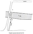 Borne 52 - Allemagne-Luxembourg-Belgique.jpg 650 × 660; 59 KB
-
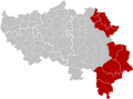
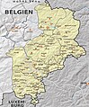
 Communauté germanophone province de Liège.png 290 × 220; 5 KB
-
 Communauté germanophone province de Liège.svg 977 × 721; 3.11 MB
-
 Duitstalige GemeenschapGemeenten.png 100 × 220; 3 KB
-
 Duitstalige GemeenschapLocatie.png 270 × 270; 1 KB
-
 Duitstalige GemeenschapLocatie.svg 319 × 261; 76 KB
-
 Eupen-MalmedyGrenzveränderungen.jpg 1,472 × 1,500; 158 KB
-
 Ex-Frontière Belgo-Prussienne - Borne 157 - 193.jpg 2,073 × 3,129; 782 KB
-
 Ex-Frontière Belgo-Prussienne - Borne 75 - 157.jpg 663 × 1,137; 133 KB
-
 German-speaking community belgium-blank.svg 638 × 957; 2.85 MB
-
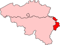
 German-Speaking Community in Belgium and Europe.svg 680 × 520; 2.36 MB
-
 German-speaking electoral college.svg 535 × 395; 30 KB
-
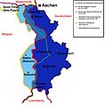
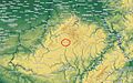
 Großregion Karte.jpg 630 × 630; 76 KB
-
 Kanton StVith Belgische Eifel.jpg 1,494 × 1,803; 709 KB
-
 Karte Deutschsprachige Gemeinschaft Gemeinden und Orte gesamt.jpg 1,627 × 2,941; 1.29 MB
-
 Karte Deutschsprachige Gemeinschaft.svg 578 × 1,123; 2.32 MB
-
 Karte Eupener Land.jpg 1,573 × 1,107; 447 KB
-
 Karte Hohes Venn.png 720 × 726; 141 KB
-
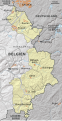
 Karte Ostbelgien.svg 578 × 1,123; 1.4 MB
-
 Lage der Gemeinde Kelmis im Dreiländereck B-D-NL.jpg 600 × 480; 226 KB
-
 Ostbelgien.jpg 394 × 788; 55 KB
-
 Ostbelgien2.png 394 × 788; 26 KB
-
 Sankt Vith.JPG 1,315 × 817; 318 KB


