Category:Maps of the Ghana Empire
Media in category "Maps of the Ghana Empire"
The following 18 files are in this category, out of 18 total.
-
 Africa historical traite.JPG 2,667 × 2,287; 572 KB
-
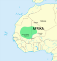
 Ancient Ghana map.png 524 × 519; 16 KB
-
 Empire ghana.png 410 × 429; 77 KB
-
 Empire of Ghana.png 961 × 717; 47 KB
-
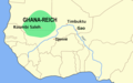
 GHANA empire map BLANK.png 1,580 × 988; 36 KB
-
 Ghana empire map-fr.png 844 × 864; 2.79 MB
-
 Ghana empire map.png 984 × 864; 51 KB
-
 Ghana reich karte-es.svg 706 × 721; 781 KB
-
 Ghana reich karte.png 2,321 × 2,475; 438 KB
-
 Ghana successor map 1200 ru.jpg 428 × 448; 34 KB
-
 Impero del Ghana.png 844 × 864; 46 KB
-
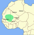
 Kingdom of Ghana & Trans-Saharan Trade about 11th century.JPG 583 × 479; 60 KB
-
 Mapa ghana-pt.svg 512 × 442; 14 KB
-
 Reich Ghana.png 3,518 × 3,351; 977 KB
-
 Reich von ghana.png 1,580 × 988; 41 KB
-
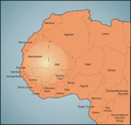
 Senegal map7.jpg 680 × 563; 83 KB
-
 The Ghana Empire.svg 451 × 311; 3.07 MB
-
 Αυτοκρατορία Γκάνα χάρτης.png 984 × 864; 50 KB


