Category:Maps of the Green River (Colorado River)
Media in category "Maps of the Green River (Colorado River)"
The following 17 files are in this category, out of 17 total.
-
 78 of 'History of Utah ... 1540-1887. (With a bibliography.)' (11206537053).jpg 1,462 × 1,525; 445 KB
-
 Bancroft's Works History of the Northwest Coast vol 2 (1884) (14758769536).jpg 2,009 × 2,108; 647 KB
-
 Coloradorivermap (Utah detail).jpg 799 × 652; 402 KB
-
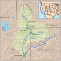
 Coloradorivermapnew1.jpg 871 × 1,130; 701 KB
-
 Duchesne river basin map.png 1,206 × 1,046; 2.08 MB
-
 Duchesnerivermap.png 720 × 586; 300 KB
-
 Echo Park Dam proposal.png 1,405 × 1,273; 2.48 MB
-
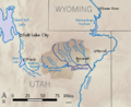
 Greenutrivermap.png 500 × 500; 409 KB
-

-

-

-

-

-

-
 Sevierrivermap.png 500 × 500; 405 KB
-
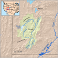
 Uinta Basin map.png 976 × 561; 77 KB
-
 Wpdms nasa topo green river utah.jpg 300 × 300; 60 KB
%27_(11206537053).jpg)
_(14758769536).jpg)
.jpg)


.jpg)
.jpg)
.jpg)
.jpg)
.jpg)
.jpg)


