Category:Maps of the Gulf of Corinth
Media in category "Maps of the Gulf of Corinth"
The following 17 files are in this category, out of 17 total.
-

-
 Admiralty Chart No 1600 Akra Psaromita to Akra Ay Theodoroi, Published 1955.jpg 16,382 × 11,257; 34.18 MB
-
 Admiralty Chart No 1676 Akra Killini to Akra Saromita, Published 1954.jpg 16,190 × 11,067; 44.76 MB
-
-
 Gulf of Corinth Fault Map.jpg 755 × 320; 39 KB
-
 Gulf of Corinth.png 200 × 204; 16 KB
-
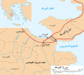 Isthmus of Corinth-ar.svg 672 × 600; 144 KB
-
 Isthmus of Corinth-es.svg 672 × 600; 250 KB
-
 Isthmus of Corinth.svg 672 × 600; 117 KB
-

-
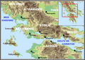 Le golfe de corinthe.png 630 × 454; 361 KB
-
 Lepanto (BM 1898,0725.8.1101).jpg 1,398 × 901; 399 KB
-
 Llac copais despres segle XIX.jpg 1,518 × 543; 804 KB
-
 Map of the gulfs of Corinth and Patras - Camocio Giovanni Francesco - 1574.jpg 1,500 × 1,111; 984 KB
-
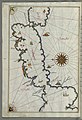
 Morea Pars - Dapper Olfert - 1688.jpg 1,500 × 1,243; 1.02 MB
-
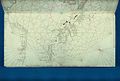
 Piri Reis - Map of Saronikos Bay - Walters W658133A - Full Page.jpg 1,228 × 1,800; 2.8 MB
-
 Series 1404 sheet 343-B Patrai, published 1959.jpg 6,902 × 5,923; 14.42 MB


.jpg)


.jpg)