Category:Maps of the Hudson Strait
Media in category "Maps of the Hudson Strait"
The following 13 files are in this category, out of 13 total.
-
 Baffin Chart of Hudson Strait.png 1,212 × 960; 1.16 MB
-
 Carte de Groenland (1647) - Isaac La Peyrère - 1 full.png 8,287 × 3,623; 30.42 MB
-
 Carte pour suivre la campagne de d'Iberville dans la baie d'Hudson en 1697.jpg 2,171 × 1,633; 2.79 MB
-
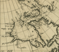
 Hudson Straat.PNG 756 × 512; 21 KB
-

-
 Luke Foxe voyage account (North-West Fox, 1635) - 2 foldout map -1 full view.png 5,742 × 4,226; 39.96 MB
-
 Luke Foxe voyage account (North-West Fox, 1635) - 3 foldout map - 2 Hudson Bay.png 1,539 × 1,360; 4.46 MB
-
 Map indicating Hudson Strait, Nunavut, Canada.png 410 × 370; 52 KB
-
 Map of Hudson Strait And Hudson Bay by Jens Munck 1624.jpg 2,099 × 1,170; 1.19 MB
-
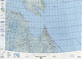 Operational Navigation Chart D-15, 4th edition.jpg 9,254 × 6,666; 16.56 MB
-
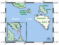 ResolutionIslandMap.png 543 × 417; 13 KB
-

-
 Ungava Bay map.png 700 × 595; 222 KB

_-_Isaac_La_Peyr%C3%A8re_-_1_full.png)


_-_3_fig_2_-_map_of_Hudson_Strait_and_Hudson_Bay.png)
_-_2_foldout_map_-1_full_view.png)
_-_3_foldout_map_-_2_Hudson_Bay.png)


_-_2_foldout_map_The_Platt_of_Sayling_-_1_full_view.png)
