Category:Maps of the Ilhas Selvagens
Media in category "Maps of the Ilhas Selvagens"
The following 24 files are in this category, out of 24 total.
-
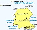
 IMRAY(1884) p0129 SALVAGE ISLANDS.jpg 3,633 × 2,703; 3.57 MB
-
 Admiralty Chart No 365 Ilheus Selvagem, Published 1942.jpg 11,268 × 16,422; 31.72 MB
-
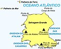 Ilha Selvagem Grande.jpg 1,010 × 814; 86 KB
-
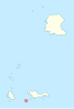
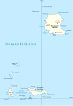
 Ilhas Selvagens location distances.svg 7,706 × 9,839; 217 KB
-
 Ilhas Selvagens location.svg 7,706 × 9,839; 160 KB
-
 Ilhéu Alto location map.svg 998 × 1,455; 74 KB
-
 Ilhéu Comprido (Selvagens) location map.svg 998 × 1,455; 73 KB
-
 Ilhéu de Fora (Selvagens) location map.svg 998 × 1,455; 73 KB
-
 Ilhéu do Sul location map.svg 998 × 1,455; 74 KB
-
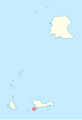 Ilhéu Grande location map.svg 998 × 1,455; 74 KB
-
 Ilhéu Pequeno location map.svg 998 × 1,455; 74 KB
-
 Ilhéu Redondo location map.svg 998 × 1,455; 74 KB
-
 Ilhéu Sinho location map.svg 998 × 1,455; 74 KB
-
 Ilhéus do Norte location map.svg 998 × 1,455; 73 KB
-
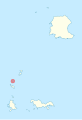
 Islas Selvagens location map.svg 998 × 1,455; 73 KB
-
 Islas Selvagens map be.png 998 × 1,455; 89 KB
-
 Islas Selvagens.svg 998 × 1,455; 520 KB
-
 Palheiro da Terra.svg 998 × 1,455; 74 KB
-
 Palheiro do Mar.svg 998 × 1,455; 74 KB
-
 PT Selvagens.PNG 500 × 413; 7 KB
-
 Selvagem Grande Island.jpg 1,010 × 814; 85 KB
-
 Selvagem Grande location map.svg 998 × 1,455; 73 KB
-
 Selvagem Pequena location map.svg 998 × 1,455; 73 KB
-
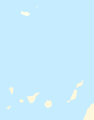
 Selvagens.png 1,000 × 1,452; 132 KB
_p0129_SALVAGE_ISLANDS.jpg)


_location_map.svg)
_location_map.svg)


