Category:Maps of the Illinois River
Media in category "Maps of the Illinois River"
The following 25 files are in this category, out of 25 total.
-
 1721 Map of the new part of French Louisiana.jpg 8,104 × 6,291; 14.19 MB
-

-
 Approximate Geographic Extent of Havana Hopewell.pdf 1,275 × 1,650; 14.29 MB
-
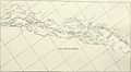
 Bulletin (1901) (19806118103).jpg 4,030 × 1,402; 1.62 MB
-
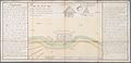
 Bulletin (1918) (14598506339).jpg 3,428 × 1,682; 380 KB
-
 Bulletin (1918) (14598535278).jpg 2,622 × 1,442; 332 KB
-
 Bulletin (1918) (14598660577).jpg 2,636 × 1,458; 347 KB
-
 Bulletin (1918) (14782818754).jpg 2,616 × 1,454; 275 KB
-
 Bulletin (1918) (14785173185).jpg 2,632 × 1,438; 284 KB
-
 Bulletin (1918) (14805020483).jpg 2,642 × 1,434; 303 KB
-
 Bulletin (1918) (14805021673).jpg 2,634 × 1,450; 280 KB
-
 Bulletin of the Illinois State Laboratory of Natural History (1901) (14576813829).jpg 4,964 × 2,034; 1.27 MB
-
 Des Plaines River.png 1,000 × 1,555; 692 KB
-

-
 FMIB 37757 Diamond I-sland-.jpeg 839 × 590; 102 KB
-
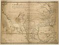
 Illinois 1718.jpg 589 × 737; 232 KB
-
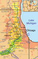
 Illinois-michigan-canal.png 626 × 531; 358 KB
-
 IllinoisRiver watershed.png 300 × 331; 100 KB
-
 Ohio archæological and historical quarterly (1887) (14578061279).jpg 1,972 × 1,428; 345 KB
-
 Pais des Illinois.jpg 780 × 570; 363 KB
-
 Plan du Fort des Sauvages Renards.jpg 6,091 × 2,942; 6.3 MB
-
 Sewage disposal (1919) (14779803815).jpg 1,544 × 2,392; 231 KB
-

-
 Starved Rock State Park.PNG 573 × 424; 45 KB
-
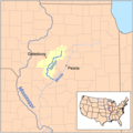 Spoonrivermap.png 500 × 500; 125 KB

_(14598506339).jpg)
_(14598535278).jpg)
_(14598660577).jpg)
_(14782818754).jpg)
_(14785173185).jpg)
_(14805020483).jpg)
_(14805021673).jpg)

_along_the_lower_Illinois_River_(1988)_(20965372542).jpg)


_(14578061279).jpg)


_(14779803815).jpg)


_(19175430298).jpg)
_(19806118103).jpg)
_(14576813829).jpg)