Category:Maps of the Indian subcontinent
Subcategories
This category has the following 4 subcategories, out of 4 total.
*
S
Media in category "Maps of the Indian subcontinent"
The following 47 files are in this category, out of 47 total.
-
 Ecozone-Biocountries-Indomalaya.svg 1,052 × 744; 337 KB
-
 Ecozone Indomalaya.svg 940 × 415; 1.36 MB
-
 Ecozone-Biocountry-Indomalaya.svg 1,054 × 465; 1.79 MB
-
 2005 Indian Subcontinent Earthquake Location.jpg 504 × 567; 88 KB
-
 Akhand Bharat (orthographic projection).png 2,048 × 2,048; 1.21 MB
-
 Akhand Bharat (orthographic projection).svg 2,048 × 2,048; 1.48 MB
-
 Akhand Bharat location map.png 2,048 × 2,048; 573 KB
-
 Akhand Bharat location map.svg 2,048 × 2,048; 757 KB
-
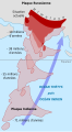
 Assam Assimilation.png 1,150 × 1,122; 2.14 MB
-
 Bharat india.jpg 2,147 × 2,093; 1.15 MB
-
 British India (orthographic projection).png 1,443 × 1,443; 531 KB
-
 British India (orthographic projection).svg 550 × 550; 2.8 MB
-
 CAJZXL8E india demis.png 690 × 502; 173 KB
-
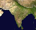
 Coastal India Satellite picture.jpg 800 × 592; 74 KB
-
 Cultural regional areas of India.png 1,199 × 1,153; 364 KB
-
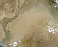 Dust Strom in India.jpg 4,400 × 3,600; 2.13 MB
-
 Himalaya-formation.gif 234 × 424; 25 KB
-
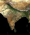
 India satellite image.png 1,278 × 946; 1.51 MB
-
 IndiaMoving-revised 09-15.jpg 470 × 851; 174 KB
-
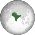
 Indian Subcontinent (orthographic projection).png 1,443 × 1,443; 529 KB
-
 Indian Subcontinent (orthographic projection).svg 550 × 550; 2.8 MB
-
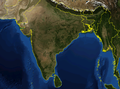
 Indian subcontinent CIA.png 1,656 × 2,124; 909 KB
-
 Indian subcontinent drift-de.svg 234 × 424; 37 KB
-
 Indian subcontinent drift-fr.svg 234 × 424; 37 KB
-
 Indian subcontinent drift-lb.svg 234 × 424; 36 KB
-
 Indian subcontinent drift-pl.svg 234 × 424; 37 KB
-
 Indian subcontinent.JPG 442 × 545; 22 KB
-
 Indian Subcontinent.jpg 2,225 × 2,185; 744 KB
-
 Indian-Subcontinent.jpg 908 × 1,061; 415 KB
-
 Indischer Subkontinent Drift.png 231 × 422; 32 KB
-
 Indostán.JPG 1,160 × 958; 144 KB
-
 Kontinentaldrift Indiens-es.svg 366 × 774; 287 KB
-
 Kontinentaldrift Indiens.svg 366 × 774; 162 KB
-
 South Asia (excluding internal borders) (orthographic projection).svg 553 × 553; 285 KB
-
 South Asia (orthographic projection) with national boundaries.png 1,443 × 1,443; 530 KB
-
 South Asia (orthographic projection) without national boundaries.svg 550 × 550; 2.8 MB
-
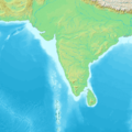
 South asia blank map mountains.png 5,152 × 4,777; 1.96 MB
-
 South Asia elevation contours.svg 800 × 787; 81.72 MB
-
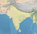
 South Asia map.jpg 2,090 × 1,916; 1.61 MB
-
 South Asia non political (light).jpg 2,324 × 2,151; 4.68 MB
-
 South Asia non political stronger colors.jpg 2,324 × 2,151; 6.39 MB
-
 South Asia non political, with rivers.jpg 2,324 × 2,151; 5.15 MB
-
 South Asia non political.jpg 2,324 × 2,151; 5.04 MB
-
 South Asia political.jpg 2,324 × 2,151; 1.88 MB
-
 Topographic30deg N0E60.png 1,800 × 1,800; 813 KB
-
 WGSRPD Indian Subcontinent.png 3,669 × 4,130; 2.62 MB
-
 Индостанская плита.png 234 × 424; 72 KB


.png)
.svg)


.png)
.svg)


.png)
.svg)


_(orthographic_projection).svg)
_with_national_boundaries.png)
_without_national_boundaries.svg)


.jpg)


