Category:Maps of the Kalmar Union
Media in category "Maps of the Kalmar Union"
The following 10 files are in this category, out of 10 total.
-
 Flag map of the Kalmar Union (Mainland).png 471 × 624; 55 KB
-
 Kalmar Union c. 1500-de.svg 590 × 685; 285 KB
-
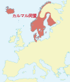 Kalmar Union c. 1500-ja.svg 590 × 685; 400 KB
-
 Kalmar Union c. 1500.svg 590 × 685; 399 KB
-
 Kalmar Union ca. 1400.svg 499 × 463; 277 KB
-
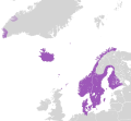
 Kalmarunionen.png 540 × 238; 70 KB
-
 Södra sverige och danmark under unionstiden med stockholm.jpg 1,524 × 1,824; 1.03 MB
-
 The Kalmar Union at the beginning of the 16 Century.PNG 949 × 926; 47 KB
-
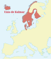 Unio de Kalmar.svg 590 × 685; 398 KB
-
 Union of Kalmar (1500).svg 450 × 500; 390 KB
.png)


.svg)