Category:Maps of the Khmer Empire
Media in category "Maps of the Khmer Empire"
The following 34 files are in this category, out of 34 total.
-
 1970 Khmer Empire (30583780310).jpg 3,112 × 4,122; 12.83 MB
-
 Asia in 1335 cn en.png 866 × 394; 123 KB
-
 Asia in 1345.svg 1,100 × 837; 1.02 MB
-
 Bản đồ Việt Nam thời Lý năm 1085.png 2,000 × 2,281; 382 KB
-
 Cambòtja - Empèri Khmer dins lo corrent dau sègle XII.png 840 × 828; 181 KB
-
 Carte Empire-Khmer.png 435 × 445; 33 KB
-
 Chien tranh dong nam a tram nam.jpg 1,300 × 1,752; 1.11 MB
-
 Indochina 1300 CE.png 628 × 717; 150 KB
-
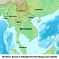 Khmer Empire 1203 Map.png 1,800 × 1,800; 2.7 MB
-
 Khmer Empire Expansion (cropped).png 2,377 × 1,419; 442 KB
-
 Khmer Empire Expansion (cropped1).png 1,956 × 1,419; 415 KB
-
 Khmer Empire Expansion.png 2,377 × 1,665; 565 KB
-
 Khmer Empire1.png 271 × 263; 12 KB
-
 Khmer Map Phnom Penh 0558.jpg 1,944 × 2,592; 2.71 MB
-
 Khmer.2.jpg 271 × 263; 8 KB
-
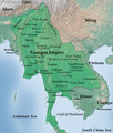 Map of Taungoo Empire (1580).png 950 × 1,121; 1.5 MB
-
 Map-of-southeast-asia 1000 - 1100 CE-es.svg 744 × 1,047; 944 KB
-
 Map-of-southeast-asia 1000 - 1100 CE.png 791 × 1,114; 162 KB
-
 Map-of-southeast-asia 1300 CE-es.svg 744 × 1,047; 1,015 KB
-
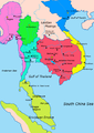
 Map-of-southeast-asia 1300 CE.png 800 × 1,125; 251 KB
-
 Map-of-southeast-asia 1400 CE-es.svg 791 × 1,114; 535 KB
-
 Map-of-southeast-asia 1400 CE.png 791 × 1,114; 190 KB
-
 Map-of-southeast-asia 900 CE-es.svg 744 × 1,047; 679 KB
-
 Map-of-southeast-asia 900 CE-hu.svg 791 × 1,114; 131 KB
-
 Map-of-southeast-asia 900 CE-ko.svg 791 × 1,114; 127 KB
-
 Map-of-southeast-asia 900 CE.png 791 × 1,114; 182 KB
-
 Map-of-southeast-asia 900 CE.svg 791 × 1,114; 124 KB
-
 Mappa Impero Khmer (it).svg 791 × 1,114; 133 KB
-
 Mappa Impero Khmer.png 791 × 1,114; 144 KB
-
 Southeast Asian history - 13th century (Thai language).png 840 × 1,280; 416 KB
-
 Southeast Asian history - 13th century-es.svg 709 × 872; 1.23 MB
-
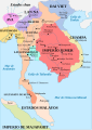
 Southeast Asian history - 13th century.png 753 × 1,147; 159 KB
-
 Vietnam1650.GIF 428 × 713; 15 KB
-
 VietnamMac1540.gif 428 × 713; 14 KB
.jpg)


.png)
.png)


.png)


.svg)

.png)


