Category:Maps of the Kingdom of Dalmatia
Media in category "Maps of the Kingdom of Dalmatia"
The following 16 files are in this category, out of 16 total.
-
 (1879) MAP OF CROATIA, SLAVONIA, DALMATIA & 'MILITÄRGRENZE' of AUSTRIAN EMPIRE.jpg 5,109 × 5,033; 10.02 MB
-

-
 Dalmatia1911.png 460 × 363; 438 KB
-
 Dalmatien Donaumonarchie.png 674 × 510; 24 KB
-
 Donaumonarchie Dalmatië.png 519 × 393; 12 KB
-
 Empire d'Autriche 1914 Dalmatie.png 3,507 × 2,480; 3.82 MB
-
 Kingdom of Dalmatia-1868.png 542 × 502; 35 KB
-
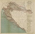
 Kingdom of Dalmatia.jpg 625 × 530; 355 KB
-
 Map of the Kingdom of Croatia (1848).png 542 × 502; 39 KB
-
 Map of the Kingdom of Croatia (1868).png 542 × 502; 40 KB
-
 Map of the Kingdom of Croatia-Slavonia (1885).png 542 × 502; 31 KB
-
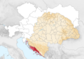
 Religioni dalmazia.png 988 × 492; 888 KB
-
 Triune Kingdom of Croatia (1868-1918)-de.svg 512 × 382; 189 KB
-
 Triune Kingdom of Croatia (1868-1918)-es.svg 2,162 × 1,614; 385 KB
-
 Triune Kingdom of Croatia (1868-1918)-hu.svg 2,162 × 1,614; 257 KB
-
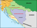
 Triune Kingdom of Croatia (1868-1918).png 826 × 798; 113 KB
_MAP_OF_CROATIA,_SLAVONIA,_DALMATIA_%26_%27MILIT%C3%84RGRENZE%27_of_AUSTRIAN_EMPIRE.jpg)


.png)
.png)
.png)

-de.svg)
-es.svg)
-hu.svg)
.png)