Category:Maps of the Landkreis Ludwigsburg
Urban districts (cities): Baden-Baden · Freiburg · Heidelberg · Heilbronn · Karlsruhe · Mannheim · Pforzheim · Stuttgart · Ulm
Use the appropriate category for maps showing all or a large part of Ludwigsburg District. See subcategories for smaller areas:
| If the map shows | Category to use |
|---|---|
| Ludwigsburg District on a recently created map | Category:Maps of the Landkreis Ludwigsburg or its subcategories |
| Ludwigsburg District on a map created more than 70 years ago | Category:Old maps of Landkreis Ludwigsburg or its subcategories |
| the history of Ludwigsburg District on a recently created map | Category:Maps of the history of Landkreis Ludwigsburg or its subcategories |
| the history of Ludwigsburg District on a map created more than 70 years ago | Category:Old maps of the history of Landkreis Ludwigsburg or its subcategories |
Subcategories
This category has the following 3 subcategories, out of 3 total.
Media in category "Maps of the Landkreis Ludwigsburg"
The following 13 files are in this category, out of 13 total.
-
 Baden wuerttemberg lb.png 221 × 245; 13 KB
-
 Bahnstreckennetz LK Ludwigsburg.png 1,000 × 900; 333 KB
-
 Bahnstreckennetz LK Ludwigsburg.svg 1,000 × 900; 252 KB
-
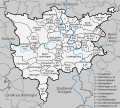
 Karte Landkreis Ludwigsburg.png 1,000 × 900; 388 KB
-
 Karte Landkreis Ludwigsburg.svg 1,000 × 900; 356 KB
-
 Karte Strohgaeu.png 800 × 558; 461 KB
-
 Lage des Landkreises Ludwigsburg in Deutschland.PNG 197 × 235; 4 KB
-
 Langes Feld Karte Kern- und Randzonen.jpg 1,209 × 997; 842 KB
-
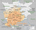
 LB in Baden-Württemberg.svg 753 × 868; 159 KB
-
 Locator map LB in Baden-Württemberg.svg 1,058 × 1,161; 278 KB
-
 Locator map LB in Germany.svg 1,075 × 1,273; 578 KB
-
 Strohgäu im Landkreis Ludwigsburg.svg 1,000 × 900; 231 KB
-
 Strohgäu-Karte Kernzone und Naturraumeinheiten.jpg 1,209 × 997; 822 KB


