Category:Maps of the London Borough of Havering
Media in category "Maps of the London Borough of Havering"
The following 16 files are in this category, out of 16 total.
-
 Districts of thames gateway.png 810 × 419; 18 KB
-
 Havering London UK blank ward map 2022.svg 512 × 615; 3.71 MB
-
 Havering London UK blank ward map.svg 1,039 × 1,266; 953 KB
-
 Havering London UK labelled ward map 2002.svg 1,003 × 1,311; 163 KB
-
 Havering London UK location map.svg 1,039 × 1,266; 1.85 MB
-
 HaveringLU.svg 857 × 359; 11 KB
-
 Hornchurch essex 1961.png 1,200 × 943; 45 KB
-
 London Loop Plaque - geograph.org.uk - 1061602.jpg 640 × 525; 106 KB
-
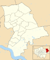
 LondonHavering.png 200 × 155; 23 KB
-
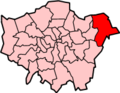
 LondonHavering.svg 962 × 744; 19 KB
-
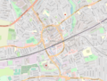
 Osm cranham map.png 213 × 388; 45 KB
-
 Romford borough 1911.png 2,742 × 1,769; 75 KB
-
 Romford essex 1961.png 1,200 × 943; 44 KB
-
 Romford london map.png 1,170 × 891; 1.02 MB
-
 Romford rural 1911.PNG 759 × 789; 27 KB
-
 Romford rural 1931.PNG 562 × 670; 17 KB


