Category:Maps of the London Underground lines
Subcategories
This category has the following 11 subcategories, out of 11 total.
B
C
- Maps of the Circle line (14 F)
D
- Maps of the District line (8 F)
H
J
- Maps of the Jubilee line (5 F)
M
- Maps of the Metropolitan line (19 F)
N
P
- Maps of the Piccadilly line (25 F)
V
- Maps of the Victoria line (5 F)
W
Media in category "Maps of the London Underground lines"
The following 4 files are in this category, out of 4 total.
-
 East London Line.png 522 × 800; 15 KB
-
 East London Line.svg 250 × 450; 9 KB
-
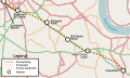
 London Underground Northern line extension map.svg 1,175 × 807; 207 KB
-
 London Underground proposed Bakerloo line extension map.svg 993 × 593; 145 KB


