Category:Maps of the MBTA Green Line
Subcategories
This category has the following 2 subcategories, out of 2 total.
M
Media in category "Maps of the MBTA Green Line"
The following 16 files are in this category, out of 16 total.
-
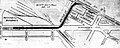 1936 map of planned Huntington Avenue Subway.jpg 1,562 × 629; 216 KB
-
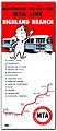 1959 MTA Highland Branch flier.jpg 563 × 1,303; 148 KB
-
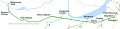
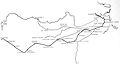 1972 MBTA Green Line map with Riverside Line highlighted.jpg 2,872 × 1,534; 200 KB
-
 Boston central subway portals over time.jpg 1,152 × 800; 591 KB
-
 Boylston plan.png 3,596 × 2,205; 2.43 MB
-
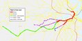
 GLX Phase 1.svg 1,080 × 700; 2.35 MB
-
 Green Line A Branch map.svg 3,200 × 750; 147 KB
-
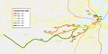
 Green Line branches.jpg 1,966 × 1,312; 995 KB
-
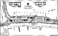
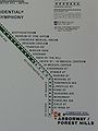 Heath Street map at Hynes.jpg 552 × 736; 162 KB
-
 Map of Huntington Avenue Subway, 1937.jpg 2,262 × 966; 239 KB
-
 MBTA Green Line construction date map.pdf 1,800 × 900; 258 KB
-
 MBTA Green Line physical characteristics map.pdf 1,800 × 900; 373 KB
-
 MBTA Green Line route diagram.png 1,216 × 636; 164 KB
-
 MBTA Green Line.svg 1,150 × 1,050; 61 KB
-
 Park Street plan.png 3,580 × 2,182; 2.56 MB
-
 Riverside.svg 1,800 × 1,960; 36 KB


