Category:Maps of the Mali Empire
Media in category "Maps of the Mali Empire"
The following 32 files are in this category, out of 32 total.
-
 The Mali Empire.jpg 3,000 × 2,250; 3.07 MB
-
 Africa historical traite.JPG 2,667 × 2,287; 572 KB
-
 African-civilizations-map-imperial.png 2,000 × 1,863; 4.67 MB
-
 African-civilizations-map-pre-colonial es.svg 1,390 × 1,295; 294 KB
-
 African-civilizations-map-pre-colonial mk.svg 1,390 × 1,295; 947 KB
-
 African-civilizations-map-pre-colonial.svg 1,390 × 1,295; 488 KB
-
 Empire du Mali carte Fr.png 1,579 × 986; 172 KB
-
 MALI empire BLANK.PNG 1,580 × 988; 60 KB
-
 MALI empire BLANK.svg 1,668 × 1,214; 43 KB
-
 Mali empire map - 1350 AD - el.svg 512 × 366; 15 KB
-
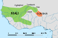
 MALI empire map-ar.png 1,580 × 994; 125 KB
-
 MALI empire map.PNG 1,580 × 994; 70 KB
-
 MALI reich Karte.PNG 1,580 × 994; 49 KB
-
 Maliko inperioa.png 1,580 × 994; 124 KB
-
 Maliko inperioa.svg 2,107 × 1,325; 170 KB
-
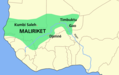 Maliriket.png 1,580 × 994; 50 KB
-
 Map of ancient and Medieval Sub-Saharan states zoomed in.jpg 658 × 519; 131 KB
-
 Map of the Mali Empire.png 2,030 × 1,431; 50 KB
-
 Mapa Imperio de Mali.jpg 4,213 × 2,277; 15.11 MB
-
 Mapa mali cy.svg 1,668 × 1,214; 68 KB
-
 Mapa mali-pt.svg 512 × 366; 16 KB
-
 Mapa mali.svg 1,668 × 1,214; 75 KB
-
 WestAfrica1350-ar.png 413 × 291; 18 KB
-
 WestAfrica1350-es.svg 606 × 397; 496 KB
-
 WestAfrica1350-pt.svg 606 × 397; 496 KB
-
 WestAfrica1350.png 413 × 291; 14 KB
-
 WestAfrica1530-es.svg 606 × 397; 560 KB
-
 WestAfrica1530-pt.svg 606 × 397; 490 KB
-
 WestAfrica1530.png 431 × 287; 16 KB
-
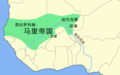 Zh MALI empire map.png 1,580 × 994; 46 KB
-
 Αυτοκρατορία Μάλι χάρτης.png 1,580 × 994; 47 KB
-
 Доколоніальні цивілізації Африки.svg 1,390 × 1,295; 486 KB


