Category:Maps of the Maratha Confederacy
Subcategories
This category has only the following subcategory.
T
Media in category "Maps of the Maratha Confederacy"
The following 53 files are in this category, out of 53 total.
-

-
 1800 Faden Rennell Wall Map of India - Geographicus - India-faden-1795.jpg 6,000 × 7,353; 10.85 MB
-
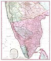 1800 Map of Peninsular India-1795.jpg 5,936 × 7,137; 50.39 MB
-

-

-
 A map of Hindoostan, or the Mogul Empire, 1788.jpg 4,000 × 3,412; 2.71 MB
-

-

-

-
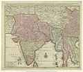
 Hindoostan LOC 2009582749.jpg 9,772 × 10,507; 12.95 MB
-
 Hindoostan LOC 2009582749.tif 9,772 × 10,507; 293.75 MB
-
 Hindustan, 1803.jpg 1,827 × 1,543; 400 KB
-
 India 1760-es.svg 2,151 × 2,546; 2.32 MB
-
 India 1792 shepherd 1923.jpg 1,509 × 2,337; 2.4 MB
-
 India in 1792.jpg 1,477 × 2,236; 3.62 MB
-
 India map 1700 1792.jpg 1,477 × 2,158; 1.16 MB
-
 Joppen1907India1795a.jpg 828 × 1,200; 287 KB
-
 Joppen1907India1805a-21-es.svg 1,208 × 1,448; 2.78 MB
-
 Joppen1907India1805a-21.jpg 843 × 1,200; 289 KB
-
 Joppen1907India1805a.jpg 843 × 1,200; 230 KB
-
 Joppenshivaji.jpg 822 × 1,538; 185 KB
-
-
 Karta marathriket 1790.jpg 254 × 325; 17 KB
-
 Larger map of marathas from "Historical Atlas of India," by Charles Joppen.jpg 1,255 × 1,824; 285 KB
-
 Map of Afzalkhan campaign.jpg 856 × 602; 485 KB
-
 Map of the Maratha Empire 1760.svg 1,486 × 1,734; 170 KB
-
 Map showing places of Shivaji's campaigns.jpg 1,145 × 1,702; 371 KB
-
 Map to illustrate Shahu's war against the Siddis of Janjira 1733-36.jpg 1,473 × 2,509; 589 KB
-
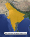
 Maratha Empire 1674 - 1818 ad (hy).png 429 × 600; 53 KB
-
 Maratha Empire 1674 - 1818 ad.PNG 503 × 703; 10 KB
-
 Maratha Empire 1680.PNG 500 × 590; 48 KB
-
 Maratha Empire in 1758.png 800 × 928; 381 KB
-
 Maratha empire under Chhatrapati Shivaji Maharaj.png 4,000 × 5,000; 14.37 MB
-
 Maratha Empire.png 359 × 443; 288 KB
-
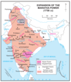
 Maratha Expansion under Shahu and Bajirao.jpg 1,692 × 2,241; 822 KB
-
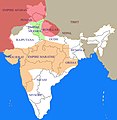
 MarathaEmpire1759.png 602 × 643; 98 KB
-
 Marathas.GIF 400 × 337; 11 KB
-
 Marathas.JPG 442 × 360; 9 KB
-
 Marathe-es.svg 1,594 × 1,868; 329 KB
-
 Marathe.jpg 400 × 411; 28 KB
-
 Moghul india.png 800 × 651; 41 KB
-
 Palkhed Campaign of Marathas under Bajirao.jpg 2,262 × 1,572; 552 KB
-
 Portuguese possessions in the Province of North.jpg 738 × 1,178; 361 KB
-
 Principal roads and divisions of Hindoostan Rennell 1788.jpg 3,358 × 3,384; 3.56 MB
-
 Retreat of Col Monson 1804.jpg 1,547 × 2,191; 482 KB
-
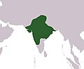
 Shivaji's kingdom 1680.jpg 274 × 371; 47 KB
-
 Shivaji's Kingdom 1680.jpg 936 × 1,300; 469 KB
-
 Shivaji's kingdom-ar.png 462 × 531; 307 KB
-
 Shivaji's retreat from Panhala to Vishalgad.jpg 935 × 646; 152 KB
-
 Shivájí, the Marátthá, his life and times (1915) (14779744754).jpg 2,832 × 1,448; 308 KB
-
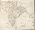
 The East Indies with the roads LOC 2013593205.jpg 16,818 × 13,465; 30.58 MB
-
 The Seat of the Mahratta War.jpg 4,000 × 2,910; 1.87 MB
-
 Wellesleys campaign against Dhondji Wagh 1800.jpg 1,522 × 1,655; 394 KB


%27_(11137415455).jpg)
%27_(11103819065).jpg)

.jpg)


.png)


_(14779744754).jpg)


