Category:Maps of the Margraviate of Baden
Maps of Baden: Margraviate of Baden (1112–1515) · Margraviate of Baden‑Durlach (1515–1771) · Margraviate of Baden‑Baden (1515–1771) · Margraviate of Baden (1771–1803) · Electorate of Baden (1803–1806) · Grand Duchy of Baden (1806–1918) · Republic of Baden (1918–1945)
Deutsch: Karten und Kartenausschnitte der Marktgrafschaft Baden (1112-1803)
Subcategories
This category has only the following subcategory.
E
Media in category "Maps of the Margraviate of Baden"
The following 8 files are in this category, out of 8 total.
-
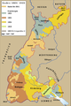
 Baden-1802-1819-variant-es.svg 460 × 690; 251 KB
-
 Baden-1802-1819-variant.svg 460 × 690; 79 KB
-
 Baden-1802-1819.svg 460 × 690; 78 KB
-
 Baden-hu.svg 460 × 690; 163 KB
-
 Baden.png 1,906 × 2,869; 695 KB
-
 Baden.svg 460 × 690; 161 KB
-
 Kaart van het westen van markizaat Baden, ca. 1701-1713, RP-P-OB-83.037-28.jpg 3,219 × 2,717; 2.93 MB
-
 Vera totius marchionatus Badensis et Hochbergensis - CBT 5877174.jpg 7,003 × 4,198; 6.2 MB


