Category:Maps of the Metropolitan Borough of Bolton
Media in category "Maps of the Metropolitan Borough of Bolton"
The following 19 files are in this category, out of 19 total.
-
 Bolton UK locator map.svg 1,425 × 993; 860 KB
-
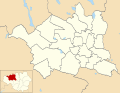 Bolton UK ward map 2010 (blank).svg 1,425 × 1,102; 336 KB
-
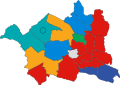 Bolton UK ward map 2024.svg 650 × 461; 279 KB
-
 Bolton unparished area UK locator map.svg 1,425 × 1,102; 225 KB
-
 BoltonNorthEast2007Constituency.svg 322 × 242; 305 KB
-
 BoltonNorthEastConstituency.svg 329 × 242; 76 KB
-
 BoltonSouthEast2007Constituency.svg 322 × 242; 305 KB
-
 BoltonSouthEastConstituency.svg 329 × 242; 76 KB
-
 BoltonWest2007Constituency.svg 322 × 242; 305 KB
-
 BoltonWestConstituency.svg 329 × 242; 76 KB
-
 EnglandBolton.png 200 × 247; 27 KB
-
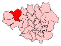
 GManc-Bolton.png 200 × 151; 15 KB
-
 GreaterManchesterBolton.png 200 × 151; 16 KB
-
 Manchester Transport Museum SELNEC Futuroute sign.jpg 2,048 × 1,536; 910 KB
-
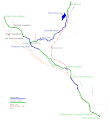 Map of the Manchester Bolton and Bury Canal with east lancs line.gif 1,515 × 1,656; 92 KB
-
 Map of the Manchester Bolton and Bury Canal.gif 1,515 × 1,656; 85 KB
-
 Map of the Manchester Bolton and Bury Canal.svg 1,100 × 1,293; 59 KB
-
 MBB canal map.gif 588 × 838; 24 KB
-
 Mbb canal map.svg 724 × 1,024; 28 KB


.svg)