Category:Maps of the Mystic River
Media in category "Maps of the Mystic River"
The following 11 files are in this category, out of 11 total.
-

-

-
-

-
 Atlas of the city of Boston - Charlestown - plate 4 (19866042805).jpg 2,000 × 1,342; 2.73 MB
-
 Charlesrivermap.png 1,000 × 1,000; 587 KB
-
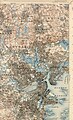 Mystic River (Massachusetts) map.jpg 1,700 × 2,800; 2.58 MB
-
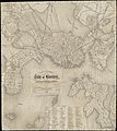
 Plan of Charlestown (3855695619).jpg 2,000 × 1,341; 2.18 MB
-
 Plan of part of Mystic River, with common low water mark of line of flats (2675201136).jpg 2,000 × 1,281; 2.24 MB
-
 Plan of real estate in Charlestown, showing park laid out (3856497224).jpg 2,000 × 1,422; 2.22 MB
-
 The Medford historical register (1898) (14577226777).jpg 2,328 × 3,540; 536 KB


.jpg)

.jpg)

_map.jpg)
.jpg)
.jpg)
.jpg)
_(14577226777).jpg)