Category:Maps of the New Georgia Islands
Media in category "Maps of the New Georgia Islands"
The following 18 files are in this category, out of 18 total.
-
 Admiralty Chart No 2601 New Georgia Wana Wana to Nbulo Island, Published 1895.jpg 7,456 × 4,968; 4.67 MB
-
 Admiralty Chart No 2392 New Georgia Vella Lavella to Wana Wana, Published 1896.jpg 4,208 × 5,816; 2.72 MB
-
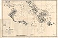
 Admiralty Chart No 1469 Guadalcanal Island to New Georgia Group, Published 1954.jpg 16,155 × 10,999; 16.66 MB
-
 Admiralty Chart No 3208 New Georgia Blackett Strait to Mongo Entrance, Published 1901.jpg 7,160 × 5,397; 4.28 MB
-
 Admiralty Chart No 3402 Santa Isabel Island to New Georgia Group, Published 1955, New Edition 1968.jpg 11,262 × 16,457; 12.43 MB
-
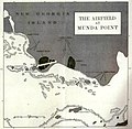 Airfield at Munda Point.jpg 1,090 × 1,067; 294 KB
-
 Blacket Strait.JPG 832 × 512; 67 KB
-
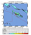 Intensity04.06.07.jpg 612 × 710; 105 KB
-
 Kolombangara General.png 5,400 × 5,400; 24.1 MB
-

-
 New Georgia Group.jpg 2,941 × 1,317; 594 KB
-
 New Georgia Island Group Map.jpg 548 × 349; 69 KB
-
 New Georgia Island Group.jpg 1,127 × 1,664; 305 KB
-
 NewGeorgiaGroupCloseup esp.jpg 3,868 × 2,520; 1.42 MB
-
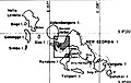
 NewGeorgiaGroupCloseup.png 967 × 630; 45 KB
-
 NewGeorgiaGroupCloseup2.JPG 967 × 630; 87 KB
-
 NewGeorgiaIslands2022OSM.png 5,755 × 3,963; 9.84 MB
-
 OSM 2023 Solomons Western.png 2,672 × 1,921; 1.92 MB


