Category:Maps of the Organization of American States
Media in category "Maps of the Organization of American States"
The following 17 files are in this category, out of 17 total.
-
 Aguas territoriales OEA.svg 800 × 400; 695 KB
-
 Continental organizations.svg 2,754 × 1,398; 1.17 MB
-
 Cuba and the Organization of American States.svg 536 × 536; 435 KB
-
 InterAmTortureConvMap.gif 427 × 625; 7 KB
-
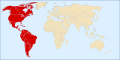 LocationOAS.svg 1,000 × 500; 2.53 MB
-
 Mapoeaestados miembros.png 384 × 387; 39 KB
-
 OAS map.png 478 × 626; 16 KB
-
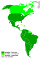
 OAS membership map.svg 384 × 387; 634 KB
-
 OAS Observer.png 1,357 × 628; 39 KB
-
 OASmap 2005.png 430 × 628; 6 KB
-
 OEA OAS Map.PNG 1,357 × 628; 45 KB
-
 OEA.svg 384 × 387; 577 KB
-

-
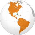
 Organization of American States (orthographic projection).svg 536 × 536; 435 KB
-
 Pacto de Bogotá países.svg 280 × 403; 520 KB
-
 Rio Pact (orthographic projection).svg 550 × 550; 1.09 MB
-
 大陆组织地图.png 1,357 × 628; 81 KB


_-_disputed_version.svg)
.svg)

.svg)
