Category:Maps of the Paracel Islands
Pages in category "Maps of the Paracel Islands"
This category contains only the following page.
Media in category "Maps of the Paracel Islands"
The following 40 files are in this category, out of 40 total.
-
-
 75967 South-China-Sea-1 (Paracel Islands cropped).jpg 1,190 × 746; 429 KB
-
 75967 South-China-Sea-1.jpg 9,570 × 6,660; 30.8 MB
-
 9 dotted line.png 979 × 1,206; 1.79 MB
-
 AmphitriteMap.jpg 298 × 313; 26 KB
-
-
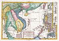
 Cambodge, Laos, Siam and Vietnam at 1760.jpg 776 × 870; 334 KB
-
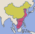 Chinaclaim.png 282 × 277; 7 KB
-
 Composite Map East Indies (cropped).png 1,691 × 2,041; 5.58 MB
-
 Composite Map East Indies.png 13,465 × 7,904; 142.65 MB
-
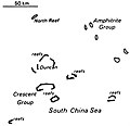
 CrescentMap.jpg 352 × 196; 25 KB
-
 HoangSa.jpg 1,150 × 2,780; 1.03 MB
-
 HoangSaVN-DongNamA1687.jpg 3,150 × 1,800; 1.92 MB
-
 Lequydon BaiCatVang.jpg 700 × 548; 43 KB
-
 Map of Paracel Islands.png 1,138 × 879; 52 KB
-
 Map-hoang-sa.png 500 × 342; 41 KB
-
 Map-Paracel Islands.png 500 × 342; 75 KB
-
-
-

-
 Paracel 88.png 972 × 405; 514 KB
-
 Paracel Islands (Vietnamese names).png 328 × 353; 80 KB
-
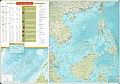
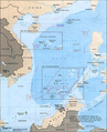
 Paracel Islands CIA.jpg 1,008 × 465; 88 KB
-
 Paracel Islands-CIA WFB Map-2.JPG 480 × 440; 89 KB
-
 Paracel Islands-CIA WFB Map.png 330 × 355; 6 KB
-
 Paracel1791.gif 400 × 500; 159 KB
-
 ParacelIs lands (Vietnamese).png 330 × 355; 8 KB
-
 ParacelIslands.png 325 × 350; 5 KB
-
 Paracels.JPG 4,200 × 8,360; 13.34 MB
-
 Paracels1827.jpg 10,100 × 6,906; 23.5 MB
-
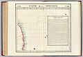
 Partie de la Cochichine atlas.jpg 660 × 635; 87 KB
-
 Pf-map.gif 328 × 353; 16 KB
-
 QuangNamThoiLe.png 347 × 550; 113 KB
-
 Schina sea 88.png 979 × 1,206; 1.79 MB
-
 Thiên Nam tứ chí lộ đồ thư.jpg 1,470 × 615; 507 KB
-
 Woody Island (South China Sea) map.svg 2,296 × 1,813; 1.27 MB
-
 World Factbook (1990) Paracel Islands.jpg 545 × 529; 36 KB
-
 Xisha-battle.JPG 640 × 480; 82 KB
-
 Xisha.png 1,953 × 1,490; 80 KB
-
 西沙海战示意图.png 642 × 442; 128 KB

.jpg)


.jpg)


.png)


_-_Paracel_Islands_(No_labels).png)
_-_Paracel_Islands_(ZHT).png)
_(cropped).jpg)

.png)


.png)


_map.svg)
_Paracel_Islands.jpg)


