Category:Maps of the Pribilof Islands
Media in category "Maps of the Pribilof Islands"
The following 21 files are in this category, out of 21 total.
-
 FMIB 33603 Lagoon Rookery.jpeg 1,173 × 1,618; 419 KB
-
 FMIB 40223 Reef Rookery, St Paul Island, 1914.jpeg 2,319 × 1,447; 540 KB
-
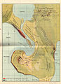
 FMIB 40224 Lagoon Rookery, St Paul Island, 1914.jpeg 928 × 1,704; 266 KB
-
 FMIB 40227 Polovina Rookery, St Paul Island, 1914.jpeg 1,438 × 1,731; 364 KB
-
 FMIB 40232 Gorbatch Rookery, St Paul Island, 1914.jpeg 2,175 × 1,439; 495 KB
-
 FMIB 40246 Little Polovina Rookery, St Paul Island, 1914.jpeg 933 × 1,652; 230 KB
-
 FMIB 40247 Ardiguen Rookery, St Paul Island, 1914.jpeg 941 × 1,530; 211 KB
-
 FMIB 40248 Zapadni Reef Rookery, St Paul Island, 1914.jpeg 977 × 1,709; 204 KB
-
 FMIB 40255 Sivutch Rookery, St Paul Island, 1914.jpeg 1,059 × 1,625; 258 KB
-
 FMIB 40259 Little Zapadni Rookery, St Paul Island, 1914.jpeg 2,149 × 1,455; 413 KB
-

-
 FMIB 44117 St George's Island (Prybilov Islands) Bering Sea.jpeg 1,827 × 1,056; 133 KB
-

-
 FMIB 45362 Map of St George Island--Pribylov Group.jpeg 1,490 × 874; 166 KB
-
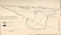
 FMIB 45371 Survey Showing the Immense Breeding Area of Novastoshnah.jpeg 847 × 693; 167 KB
-

-
 FMIB 45996 Fur-Seal Industry of the Pribylov Islands, Alaska.jpeg 2,175 × 1,638; 740 KB
-
 LocationPribilofIslands.PNG 2,929 × 1,713; 167 KB
-
 Operational Navigation chart D-10, 4th edition.jpg 9,254 × 6,676; 12.95 MB
-
 Pribilof Reservation EO 1044 illustration.jpg 1,438 × 2,031; 270 KB
-
 PribilofIslands.jpg 565 × 685; 113 KB


_Bering_Sea.jpeg)


