Category:Maps of the Principality of Achaea
Media in category "Maps of the Principality of Achaea"
The following 15 files are in this category, out of 15 total.
-
 Balkan and Byzantium in 1265-SR (Serbian).svg 1,822 × 870; 600 KB
-
 ByzantineEmpire1265-es.svg 1,708 × 816; 611 KB
-
 ByzantineEmpire1265-sr.svg 1,708 × 816; 556 KB
-
 ByzantineEmpire1265.svg 1,708 × 816; 479 KB
-
 ByzantinischesReich 1265-hu.svg 1,708 × 816; 557 KB
-
 Duché Naxos.png 730 × 600; 111 KB
-
 Glarentza1.png 684 × 552; 35 KB
-
 Greece in 1210V1.svg 3,509 × 2,000; 1.38 MB
-
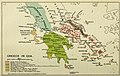 Greece in 1214.JPG 1,732 × 1,104; 669 KB
-
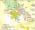 Greece in 1278.JPG 1,312 × 1,131; 163 KB
-
 LatinEmpire-fr.png 2,941 × 1,631; 1.01 MB
-
 LatinEmpire-fr.svg 2,759 × 1,532; 2.71 MB
-
 Map of the southern Balkans, 1410-es.svg 2,217 × 1,959; 2.76 MB
-
 Map of the southern Balkans, 1410.svg 2,217 × 1,959; 2.56 MB
-
 Principality of Achaea in 1278.jpg 832 × 749; 215 KB
.svg)


