Category:Maps of the Principality of Lippe
Media in category "Maps of the Principality of Lippe"
The following 29 files are in this category, out of 29 total.
-
 Neu Germania pg191 11212910766.jpg 3,275 × 1,961; 1.39 MB
-
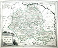
 County of Lippe, late 18th century.jpg 1,600 × 1,200; 519 KB
-
 Deutsches R Lippe.png 630 × 521; 22 KB
-
 Deutsches Reich (Karte) Lippe.svg 650 × 545; 1.04 MB
-
 Grenze gegen Lippe bei Goldbeck, Egestorf und Passenstein.tif 5,527 × 4,072; 64.41 MB
-
 HRR 1789 Fürstbistum Paderborn.png 299 × 278; 84 KB
-
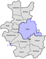
 Lippe 1923-1946.png 1,469 × 1,059; 74 KB
-
 Lippe in the German Reich (1871).svg 1,425 × 1,133; 1,014 KB
-
 Lippe in the German Reich (1925).svg 1,425 × 1,133; 967 KB
-
 Lippe innerhalb der britischen Besatzungszone 1946.svg 512 × 624; 454 KB
-
 Lippe, Paderborn and Corvey in Eastern Westphalia.jpg 2,112 × 2,816; 1.25 MB
-
 Lippe.png 1,469 × 1,059; 41 KB
-
 Map of Lippe in 1580.svg 1,056 × 744; 309 KB
-
 Map-DB-Lippe.svg 1,793 × 1,571; 1.67 MB
-
 Map-DR-Lippe.svg 2,621 × 2,224; 712 KB
-
 Map-WR-Lippe.svg 1,185 × 1,007; 541 KB
-
 Map-WR-SchaumburgLippe.svg 1,185 × 1,007; 541 KB
-
 Meyers b3 s0359a.jpg 2,048 × 1,626; 1,012 KB
-
 Monumenta Paderbornensia-Karte-1.jpeg 3,144 × 2,144; 1.84 MB
-

-
 RB Minden 1817-1831 mit Lippe beschriftet.svg 570 × 724; 100 KB
-
 RB Minden 1832-1878 mit Lippe beschriftet.svg 570 × 724; 90 KB
-
 RB Minden 1878-1911 (Bielefeld ab 1907) mit Lippe beschriftet.svg 570 × 724; 92 KB
-
 RB Minden 1911-1947 (Bielefeld ab 1930) mit Lippe beschriftet.svg 570 × 724; 94 KB
-
 RB Minden 1911-1947 (Bielefeld ab 1930) mit Lippekreisen beschriftet.svg 570 × 724; 110 KB
-
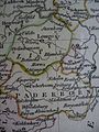
 Reilly 326.jpg 1,330 × 1,101; 672 KB
-
 Rheinprovinz,Westfalen,Hessen-Nassau,Waldeck,Lippe.jpg 4,750 × 6,481; 14.15 MB
-
 Special-Karte des Fuerstenthums Lippe - Ausschnitt Hoevelhof.jpg 739 × 482; 111 KB
-
 Stielers Handatlas 1891 10 Braunschweig.jpg 1,520 × 1,096; 1.81 MB


_Lippe.svg)


.svg)
.svg)


_Kgr._der_Niederlande,_Kgr._Belgien.jpg)


_mit_Lippe_beschriftet.svg)
_mit_Lippe_beschriftet.svg)
_mit_Lippekreisen_beschriftet.svg)


