Category:Maps of the Republic of Ragusa
Media in category "Maps of the Republic of Ragusa"
The following 26 files are in this category, out of 26 total.
-
 Venice1400.png 647 × 563; 195 KB
-
 AdriáticoVenecianoSigloXV.svg 5,144 × 1,464; 1.62 MB
-
 Atlante Veneto Volume 2 052.jpg 10,318 × 7,010; 8.74 MB
-
 Bosanski pašaluk 1600. godine.png 2,250 × 1,536; 1.27 MB
-
 Bosnia around 1412-es.svg 1,896 × 1,655; 862 KB
-
 Bosnia around 1412-sh.png 884 × 826; 113 KB
-
 Bosnia around 1412-sr.png 884 × 826; 110 KB
-
 Bosnia around 1412.png 884 × 826; 113 KB
-
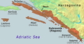
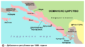 Dubrovacka republika-sr.png 768 × 428; 41 KB
-
 Dubrovacka republika.png 768 × 428; 41 KB
-
 Dubrovacka republika01.png 768 × 428; 30 KB
-
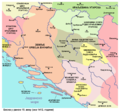
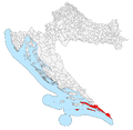 Dubrovnik Republic in Croatia.png 2,201 × 2,151; 245 KB
-
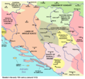
 Kingdom of Croatia 1469.png 2,230 × 1,944; 372 KB
-
 La Serbie en fin de regne de Lazar.jpg 540 × 600; 271 KB
-
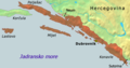
 Map of Ragusa.jpg 378 × 311; 109 KB
-
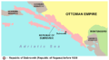
 Map of the Republic of Ragusa.png 1,023 × 907; 174 KB
-
 Ragusa hr.png 675 × 354; 112 KB
-
 Ragusa-IT.png 675 × 354; 120 KB
-
 Ragusa-RU.png 675 × 354; 118 KB
-
 Ragusa.png 675 × 354; 128 KB
-
 Reino de Serbia del kniaz Lazar.jpg 540 × 600; 126 KB
-
 Republic of Ragusa.svg 512 × 519; 1.09 MB
-
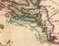 Territory of the Republic of Ragusa early 18th century.png 1,241 × 968; 2.56 MB
-
 The Republic of Ragusa in the mid-18th century.jpg 2,816 × 2,112; 2.1 MB
-
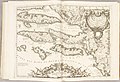
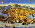 Vistaderagusa1667.jpg 827 × 669; 250 KB
-
 Zadar Treaty 1358.png 2,230 × 1,944; 379 KB


