Category:Maps of the Rhine
Deutsch: Karten vom Rhein
English: maps of the Rhine
Use the appropriate category for maps showing all or a large part of the Rhine. See subcategories for smaller areas:
| If the map shows | Category to use |
|---|---|
| the Rhine on a recently created map | Category:Maps of the Rhine or its subcategories |
| the Rhine on a map created more than 70 years ago | Category:Old maps of the Rhine or its subcategories |
| the history of the Rhine on a recently created map | Category:Maps of the history of the Rhine or its subcategories |
| the history of the Rhine on a map created more than 70 years ago | Category:Old maps of the history of the Rhine or its subcategories |
Subcategories
This category has the following 10 subcategories, out of 10 total.
*
H
O
Media in category "Maps of the Rhine"
The following 94 files are in this category, out of 94 total.
-
Belgae rivers.png 736 × 563; 251 KB
-
Carte Europe rhénane 5 nomenclature.PNG 2,550 × 3,504; 751 KB
-
Constanta-Rotterdam blank-he.svg 512 × 217; 38 KB
-
Constanta-Rotterdam blank.png 894 × 377; 29 KB
-
Constanta-Rotterdam blank.svg 512 × 217; 39 KB
-
Constanta-Rotterdam DE.PNG 894 × 377; 32 KB
-
Constanta-Rotterdam eo.png 894 × 377; 42 KB
-
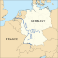
Countries of the Rhine River Map.png 1,000 × 1,000; 323 KB
-
CRS ORK-Perimeter.jpg 1,099 × 1,504; 886 KB
-
Cursus Rheni supra Argentoratum et regiones adiacentes - CBT 5876411.jpg 5,590 × 4,714; 8.41 MB
-
Das Rheinland von Basel bis Rotterdam - gezeichnet von Gust. Krätzer - btv1b102239294.jpg 2,218 × 15,293; 5.36 MB
-
De rivieren de Rijn, Waal, Lek, Merwede en Maas (3381207279).jpg 2,000 × 1,420; 623 KB
-
Euregio Rhein Waal.png 657 × 581; 140 KB
-
Europe rhenane.svg 585 × 950; 153 KB
-
Fessenheim evakuierungszonen.svg 746 × 1,024; 158 KB
-
Flusssystemkarte Rhein 01.svg 861 × 1,186; 7.81 MB
-
Flusssystemkarte Rhein 02.jpg 3,197 × 4,342; 11.75 MB
-
Flusssystemkarte Rhein 03.jpg 3,198 × 4,342; 11.75 MB
-
Flusssystemkarte Rhein 04.jpg 3,198 × 4,344; 11.72 MB
-
Flusssystemkarte Rhein 05.jpg 3,199 × 4,341; 12.35 MB
-
Flusssystemkarte Rhein 06.jpg 3,198 × 4,343; 11.74 MB
-
Hydrographia Germaniae - CBT 5873266.jpg 5,807 × 4,773; 7.5 MB
-
Karte der Moselstaustufen.png 1,480 × 2,689; 284 KB
-
Karte des Rhein-es.svg 744 × 1,052; 459 KB
-
Karte des Rhein.svg 744 × 1,052; 168 KB
-
Karte Obere Donau.png 761 × 726; 138 KB
-
Karte Umfahrung der Schiersteiner Brücke.png 1,480 × 1,996; 328 KB
-
Karte1.jpg 4,388 × 3,196; 5.1 MB
-
Kühkopf.png 3,456 × 3,777; 1.47 MB
-
Map Rhine and catchment area deutsch.jpg 2,132 × 2,891; 2.86 MB
-
Afvoerverdeling rijn.jpg 385 × 307; 22 KB
-
Afvoerverdeling rijn.svg 386 × 307; 89 KB
-
German wine regions.jpg 1,002 × 672; 211 KB
-
Karte Alpenrhein.png 708 × 1,181; 399 KB
-
Karte geldern.jpg 800 × 1,054; 198 KB
-
Karte Hochrhein.png 1,771 × 714; 394 KB
-
Rhine rift.png 300 × 529; 347 KB
-
Rhine river 3.PNG 514 × 642; 20 KB
-
Nahe Glan.png 320 × 400; 91 KB
-
Navirhin 1202854.JPG 2,206 × 3,756; 1.93 MB
-
Niederrhein-Karte.png 497 × 338; 22 KB
-
Niederrhein-region-map.png 609 × 914; 272 KB
-
Oberrheinkarte.jpg 329 × 456; 38 KB
-
Palatines rivers map.png 1,000 × 1,000; 363 KB
-
Pfaelzerwaldkarte Flussgebiete Alsenz.png 833 × 1,161; 1.53 MB
-
Pfaelzerwaldkarte Flussgebiete Appelbach-Wiesbach.png 919 × 804; 1.06 MB
-
Pfaelzerwaldkarte Flussgebiete Blies.png 1,734 × 1,650; 4.89 MB
-
Pfaelzerwaldkarte Flussgebiete Eisbach-Eckbach.png 1,120 × 649; 1,005 KB
-
Pfaelzerwaldkarte Flussgebiete Glan.png 1,383 × 1,402; 3.26 MB
-
Pfaelzerwaldkarte Flussgebiete Hauptwasserscheiden.png 2,905 × 3,417; 14.79 MB
-
Pfaelzerwaldkarte Flussgebiete Hornbach.png 900 × 888; 1.38 MB
-
Pfaelzerwaldkarte Flussgebiete Isenach.png 1,043 × 730; 1.02 MB
-
Pfaelzerwaldkarte Flussgebiete Klingbach-Erlenbach-Otterbach.png 1,135 × 721; 1.14 MB
-
Pfaelzerwaldkarte Flussgebiete Pfrimm.png 1,002 × 684; 942 KB
-
Pfaelzerwaldkarte Flussgebiete Queich.png 1,348 × 668; 1.28 MB
-
Pfaelzerwaldkarte Flussgebiete Sauer.png 1,492 × 1,110; 2.23 MB
-
Pfaelzerwaldkarte Flussgebiete Schwarzbach.png 1,290 × 1,406; 3.16 MB
-
Pfaelzerwaldkarte Flussgebiete Speyerbach.png 1,268 × 949; 1.7 MB
-
Pfaelzerwaldkarte Flussgebiete Waldlauter.png 1,036 × 821; 1.37 MB
-
Pfaelzerwaldkarte Flussgebiete Wieslauter.png 1,490 × 1,162; 2.65 MB
-
Pfaelzerwaldkarte Flussgebiete.png 2,905 × 3,417; 14.74 MB
-
Radolfzelleraach.png 270 × 222; 23 KB
-
Rhein Verlaufskarte.png 1,080 × 1,498; 2.19 MB
-
Rhein-Karte.png 794 × 1,114; 73 KB
-
Rhein-Karte2 hu.svg 1,059 × 1,485; 271 KB
-
Rhein-Karte2-ar.png 1,270 × 1,782; 630 KB
-
Rhein-Karte2.png 1,588 × 2,228; 133 KB
-
Rheinhessen Relief Karte.png 1,031 × 1,183; 1.23 MB
-
RheinsteigRouteMap.PNG 977 × 1,061; 1.98 MB
-
Rheinsystem blanco.jpg 3,196 × 4,342; 10.46 MB
-
Rheinsystem small blanco.jpg 2,133 × 2,889; 2.19 MB
-
Rheinsystem small DE Main.png 2,133 × 2,885; 9.82 MB
-
Rheinsystem small deutsch.jpg 2,133 × 2,885; 2.8 MB
-
Rheinsystem small english.jpg 2,133 × 2,888; 2.85 MB
-
Rheinsystem small francais.jpg 2,133 × 2,888; 2.86 MB
-
Rheinsystem small internat.jpg 2,133 × 2,890; 2.87 MB
-
Rheinsystem small nederlands.jpg 2,133 × 2,885; 2.85 MB
-
RHENVS Fluviorum Europae celeberrimus.jpg 3,200 × 1,472; 1.96 MB
-
Rhin alpestre bassin.svg 343 × 401; 453 KB
-
Rhine area analisys.svg 585 × 950; 275 KB
-
Rhine area analysis de.svg 585 × 950; 274 KB
-
Rhine Map (PSF).png 1,292 × 1,811; 169 KB
-
Rhine watershed closer.gif 409 × 570; 11 KB
-
Rijn-Maas-water %.png 1,200 × 1,299; 67 KB
-
Stroomgebied rijn.png 882 × 638; 40 KB
-
Wahrschaustationen.png 547 × 980; 525 KB
-
Water divide Rhine Weser.png 937 × 791; 204 KB
-
Ρήνος απορροή.jpg 2,133 × 2,889; 5.22 MB


