Category:Maps of the Rugii
Media in category "Maps of the Rugii"
The following 21 files are in this category, out of 21 total.
-
 01645 Blaeu 1645 - Germaniae veteris typus, Suevi, cropped.png 1,559 × 904; 2.83 MB
-
 Cesare prima Gallia 58 a.C.jpg 1,704 × 1,181; 633 KB
-
 Europa Germanen 50 n Chr.svg 941 × 655; 710 KB
-
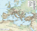
 Europe and the Near East at 476 AD.png 2,830 × 1,967; 1.58 MB
-
 Germanen 50 n. Chr.png 969 × 700; 211 KB
-
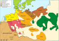
 Germani secondo PLINIO 78 e TACITO 98 AD.png 1,349 × 1,400; 588 KB
-
 Huns450.png 719 × 697; 185 KB
-
 Huns450es.svg 3,202 × 2,535; 1.06 MB
-
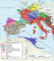
 Kmene v Podunají.png 982 × 642; 688 KB
-
 MajorianEmpire.png 1,220 × 1,385; 1.51 MB
-
 Roman Empire 125 general map-zh.svg 2,732 × 2,271; 6.55 MB
-
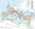
 Roman Empire 125 general map.SVG 2,186 × 1,817; 1.77 MB
-
 Roman Empire 125 political map-de.svg 2,186 × 1,817; 6.32 MB
-
 Roman Empire 125 political map-zh.png 2,049 × 1,703; 2.99 MB
-
 Roman Empire 125 political map-zh.svg 2,732 × 2,271; 2.02 MB
-
 Roman Empire 125 political map.png 2,186 × 1,817; 3.21 MB
-
 Roman Empire 125 political map.svg 2,186 × 1,817; 3.25 MB
-
 Roman Empire 460 CE-de.svg 1,220 × 1,385; 2.49 MB
-
 Roman Empire 460 CE-hu.svg 1,220 × 1,385; 2.47 MB
-
 Roman Empire 460 pl.svg 1,220 × 1,385; 2.5 MB
-
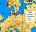 Rugii.PNG 634 × 577; 96 KB


