Category:Maps of the Ruhr area
Subcategories
This category has the following 3 subcategories, out of 3 total.
Media in category "Maps of the Ruhr area"
The following 46 files are in this category, out of 46 total.
-

-
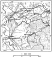
 Adelshäuser im Amt Bochum.jpg 4,906 × 4,828; 9.26 MB
-

-
 Das Ruhrgebiet als Seenplatte.jpg 800 × 445; 103 KB
-
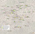
 Dekanat Emschertal.jpg 1,176 × 772; 143 KB
-
 Enemy Ground Defenses and Supply Installation - Essen (East) - NARA - 100385043.jpg 6,612 × 8,718; 5.44 MB
-
 Enemy Ground Defenses and Supply Installations - Bonn (East) - NARA - 100385039.jpg 6,688 × 8,678; 4.77 MB
-
 Enemy Ground Defenses and Supply Installations - Essen (West) - NARA - 100385041.jpg 6,652 × 8,414; 5.74 MB
-
 Enemy Ground Defenses and Supply Installations - Köln (East) - NARA - 100385037.jpg 6,660 × 8,049; 4.8 MB
-
 Enemy Ground Defenses and Supply Installations - Köln (West) - NARA - 100385027.jpg 6,700 × 8,671; 5.07 MB
-
 Essen-1932.jpg 1,532 × 1,659; 500 KB
-
 Flugkontrollzone-ruhrgebiet-01.jpg 573 × 381; 93 KB
-
 Flugkontrollzone-ruhrgebiet-02.jpg 667 × 397; 108 KB
-
 Flugkontrollzonen-ruhrgebiet-uebersicht.jpg 717 × 401; 131 KB
-
 Grundriss Ruhrgebiet.jpg 6,544 × 3,238; 3.28 MB
-
 Hattingen - Isenberg 02 ies.jpg 3,888 × 2,592; 1.81 MB
-

-
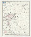
 Karte Ruhrgebiet und Umgebung um 1895.jpg 7,801 × 7,997; 120.99 MB
-

-
 Lage des Ruhrgebiets.png 176 × 234; 5 KB
-

-

-

-
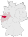
 Locator map RVR in Germany.svg 1,075 × 1,273; 637 KB
-
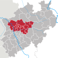
 Locator map RVR in North Rhine-Westphalia.svg 657 × 656; 479 KB
-
 Mülheim Aquarius RIKInfoschilder02.jpg 3,264 × 2,448; 2.55 MB
-
 North rhine w RVR.svg 660 × 660; 223 KB
-
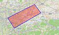
 P321 - N° 572. District industriel de la Ruhr. - Liv4-Ch09.png 1,444 × 1,614; 707 KB
-
 Radschnellweg RS1.png 638 × 249; 18 KB
-
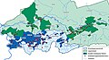
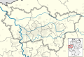 Regionalverband Ruhr location map 02.svg 7,042 × 4,764; 981 KB
-
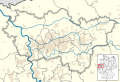 Regionalverband Ruhr location map 03.svg 7,042 × 4,764; 981 KB
-
 Regionalverband Ruhr location map 04.svg 7,042 × 4,764; 1,006 KB
-
 Regionalverband Ruhr location map.svg 7,042 × 4,764; 981 KB
-
 Rheinisch Westfaelisches Kohlengebiet 1896.jpg 902 × 596; 198 KB
-
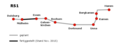
 RS1 Verlauf.png 2,729 × 1,400; 150 KB
-
 Ruhr area-administration.png 1,000 × 593; 72 KB
-
 Ruhr area-map.png 1,000 × 593; 86 KB
-
 Ruhrgebiet - btv1b8460028s.jpg 8,731 × 8,400; 12.53 MB
-
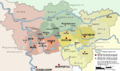
 Ruhrgebiet politisch.png 1,050 × 600; 90 KB
-
 Ruhrgebietswappenkarte (Hauswand).JPG 3,476 × 2,042; 2.43 MB
-
 Ruhrschifffahrt.jpg 9,534 × 2,394; 8.94 MB
-
 StadtbahnRR.png 6,299 × 4,252; 1.66 MB
-
-

-

-

.jpg)


_-_NARA_-_100385043.jpg)
_-_NARA_-_100385039.jpg)
_-_NARA_-_100385041.jpg)
_-_NARA_-_100385037.jpg)
_-_NARA_-_100385027.jpg)


_-_gezeichnet_von_Gust._M%C3%BCller_-_btv1b530607210.jpg)


.jpg)


.JPG)


_bestehenden_Voll-u._-_Anschbiss_Eisenbahnen.._._1-100_000._Berichtigt_im_hautechn._Bureau_K%C3%B6ln,_im_Jahre_1889_-_btv1b53025050m.jpg)
