Category:Maps of the Russian Empire
Subcategories
This category has the following 12 subcategories, out of 12 total.
Media in category "Maps of the Russian Empire"
The following 59 files are in this category, out of 59 total.
-
 007 Ukrainian Cossack Hetmanate and Russian Empire 1751-ar.jpg 1,012 × 1,256; 465 KB
-
 007 Ukrainian Cossack Hetmanate and Russian Empire 1751.jpg 767 × 952; 414 KB
-
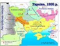 1800 Ukraine.jpg 891 × 680; 201 KB
-
 1812PRINCIPATE.png 3,445 × 1,937; 606 KB
-

-

-

-

-
 1912 China map from National Geographic.jpg 6,980 × 5,326; 10.65 MB
-

-

-
 Areas with ethnic Armenian plurality, (Russian Empire) - 1880.png 8,365 × 5,118; 1.07 MB
-
 Armenia between russian and ottoman empires-ar.png 1,712 × 1,580; 98 KB
-
 Armenia between russian and ottoman empires.png 1,712 × 1,580; 131 KB
-
 Armenian Oblast, 1828-1840.png 2,088 × 1,651; 446 KB
-
 Asia Centrala - Expansion russa de 1725 a 1914.png 2,148 × 1,536; 664 KB
-
 Atlas1737.png 1,344 × 1,019; 1.58 MB
-
 Derbent Khanate.png 2,600 × 2,600; 827 KB
-
 Flag Map of the Russian Civil War.png 1,773 × 626; 79 KB
-
 Flag Map of the Russian Empire (1814).png 577 × 474; 6 KB
-
 Flag-map of the Russian Empire (1829-1853).png 1,993 × 1,523; 30 KB
-
 Flag-map of the Russian Empire (1857).png 2,424 × 1,852; 54 KB
-
 Flag-map of the Russian Empire (1867).png 2,560 × 1,552; 71 KB
-
 Great Russians in Russian Empire by region 1897.png 1,024 × 605; 209 KB
-
 History of Russia, 1682-1762.jpg 1,330 × 1,650; 597 KB
-
 Imperii Russici tabula generalis opera et studio Ioannis Kyrilow, 1734.jpg 11,336 × 7,448; 11.71 MB
-
 KarakorumGovernment Altai.png 1,074 × 820; 54 KB
-
 Khatanga trakt.png 836 × 707; 769 KB
-
 Main centres of Polish exiles in the Russian Empire.png 2,000 × 1,181; 840 KB
-
 Map of the places where selkups live.gif 292 × 135; 1 KB
-
 Northwestern Krai of Russian Empire.jpg 1,226 × 1,080; 159 KB
-
 Political map of the Caucasus and its surroundings between 1795–1801.svg 4,973 × 2,735; 8.94 MB
-
 Ru-SPb-plan-Gilz-otdela.jpg 1,516 × 2,092; 1.77 MB
-
 Rus1500-1900.PNG 588 × 248; 38 KB
-
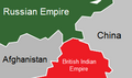 Russia-India 1865.png 296 × 174; 8 KB
-
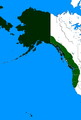 Russian claims in the americas 19th century.png 669 × 989; 28 KB
-
 Russian Empire Collapse (May 1918).png 1,431 × 1,041; 1,015 KB
-
 Russian Empire Collapse (October 1917).png 1,429 × 1,044; 827 KB
-
 Russian Empire Collapse (Sep 1918).png 1,466 × 1,036; 1,013 KB
-
 Russian Empire Flag Map Without Alaska.png 1,424 × 1,008; 93 KB
-
 Russian Empire Remastered.png 1,024 × 1,024; 284 KB
-
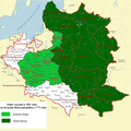 Russian Partition in 1821.png 2,350 × 2,355; 1.16 MB
-
 Size of Empires (Fuller Projection).svg 1,848 × 3,624; 1.21 MB
-
 Territorial division of the Russian Empire.png 3,000 × 1,973; 1.04 MB
-
-
 Ukraine former empires.png 757 × 805; 94 KB
-
 Versalio sutartis.png 1,482 × 734; 92 KB
-
 World in 1890.png 1,357 × 617; 36 KB
-
 Zakaukazie-Turkestan1903-Semirechye.jpg 1,600 × 1,200; 495 KB
-
 Взятие Анапы.jpg 1,928 × 1,874; 1.9 MB
-

-
 ВРП России в 1897 г.png 1,342 × 948; 488 KB
-
 Карта Кавказского края 1842 года.jpg 21,635 × 18,381; 57.63 MB
-
 Карта новопріобретеннымъ отъ Польши Россіею областямъ въ 1793 году.jpg 2,643 × 2,211; 1.37 MB
-
 Карта Северо-Кавказского Имамата на 27 мухаррама 1273 (1856 г.).jpg 4,112 × 3,464; 3.89 MB
-
 Черкаський округ.jpg 1,709 × 3,029; 576 KB
-
 පළමු ලෝක යුද්ධයට පෙර යුරෝපය.jpg 600 × 450; 46 KB
-
 සෝවියට් සංගමය.jpg 220 × 140; 12 KB
-
 黃俄羅斯計劃.jpg 623 × 338; 75 KB


_%D0%A4._386._%D0%9E%D0%BF._1._%D0%94._2863_(1).jpg)

.jpg)
_-_1880.png)


.png)
.png)
.png)
.png)


.png)
.png)
.png)


.svg)

_(14596381368).jpg)


_%D0%B7%D0%B0_1865_%D0%B3%D0%BE%D0%B4.jpg)


.jpg)


