Category:Maps of the Sacramento River
Media in category "Maps of the Sacramento River"
The following 16 files are in this category, out of 16 total.
-
 Sacramento watershed.png 288 × 307; 39 KB
-
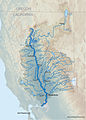
 Sacramentorivermap.jpg 650 × 950; 385 KB
-
 Sacramento Deep Water Ship Channel.png 533 × 800; 1.16 MB
-
 Wpdms usgs photo sacramento delta 2.jpg 700 × 520; 81 KB
-
 Admiralty Chart No 229 Point Pinos to Bodega Head, Published 1868, Large Corrections 1959.jpg 11,274 × 16,460; 59.85 MB
-
 Andrus Island (California).png 817 × 818; 1.18 MB
-

-
-
 California fish and game (20324946488).jpg 1,909 × 2,377; 470 KB
-

-
 PSM V61 D214 Salmon monitoring stations along the sacramento river.png 924 × 2,069; 60 KB
-
 Sacmapupdate-01.png 2,500 × 2,500; 2.76 MB
-
 Sacramento and Feather River diazinon improvements.jpg 960 × 1,242; 269 KB
-
 Sacramento River basin map.png 886 × 1,205; 1.44 MB
-
 Sacramento River Flood, California 1904.jpg 718 × 1,218; 206 KB
-
 Sacrivermap1.jpg 1,743 × 2,434; 4.79 MB


.png)
_(14591487048).jpg)
.jpg)
_(page_16_crop).jpg)


_(14591622877).jpg)