Category:Maps of the Salween River
Media in category "Maps of the Salween River"
The following 44 files are in this category, out of 44 total.
-
 Salween watershed.png 500 × 618; 113 KB
-
 'Front of Tibet' Map Painted by Wu Run-De (1907).jpg 1,000 × 827; 299 KB
-
 Der Jesuiten-Atlas der Kanghsi-Zeit - China und die Aussenlaender LOC 74650033-12.jpg 12,186 × 9,694; 12.61 MB
-
 Der Jesuiten-Atlas der Kanghsi-Zeit - China und die Aussenlaender LOC 74650033-12.tif 12,186 × 9,694; 337.98 MB
-
 Der Jesuiten-Atlas der Kanghsi-Zeit - China und die Aussenlaender LOC 74650033-18.jpg 7,414 × 9,618; 6.83 MB
-
 Der Jesuiten-Atlas der Kanghsi-Zeit - China und die Aussenlaender LOC 74650033-18.tif 7,414 × 9,618; 204.01 MB
-
 1912 China map from National Geographic.jpg 6,980 × 5,326; 10.65 MB
-
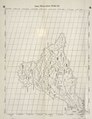
 STANFORD(1917) p53-54 PLATE16. YUNNAN (14597193058).jpg 4,733 × 3,822; 9.85 MB
-

-
 A cycle of Cathay, or, China, south and north (1897) (14595649540).jpg 2,734 × 2,348; 1.58 MB
-
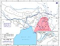 Allied lines of communication in Southeast Asia, 1942-43.jpg 1,260 × 970; 450 KB
-

-

-
 Chamagudao (no names).png 1,183 × 869; 1.77 MB
-
 Chwanpien.jpg 1,600 × 1,184; 393 KB
-
 End of the Salween campaign - 3 Nov 1944-27 Jan 1945.jpg 639 × 562; 105 KB
-
 Ethnolinguistic map of Tibet in 1983.png 528 × 790; 444 KB
-
 Exploring expeditions of Sven Hedin 1886-1935.jpg 1,200 × 823; 1.01 MB
-
 Geographic locations of Qiangic and other East Asian populations.png 4,519 × 2,456; 1.41 MB
-

-

-

-
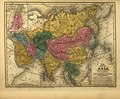
 Map of Asia, Mitchell's School Atlas LOC 2007633727-13 (cropped).jpg 3,117 × 2,378; 1.79 MB
-
 Map of Tibet in 1798, from- Map China c1798 (cropped).jpg 348 × 255; 40 KB
-
 Map of Tibet in 1831 from Ost-Indien Mit Den Inseln (cropped).jpg 1,898 × 981; 851 KB
-

-

-

-

-

-
 Mitchell's school atlas LOC 2007633727-13.jpg 3,402 × 2,814; 1.97 MB
-
 Mitchell's school atlas LOC 2007633727-13.tif 3,402 × 2,814; 27.39 MB
-
 NH-46-4 Tingching China.jpg 8,544 × 6,592; 10.95 MB
-
 Ost-Indien Mit Den Inseln.jpg 5,304 × 4,331; 7.17 MB
-
 Physical map of Tibet.png 833 × 490; 446 KB
-
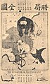 Political Map of 19th Century China(時局全圖).jpg 580 × 974; 259 KB
-
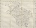
 Salween river basin map.png 1,200 × 1,844; 3.77 MB
-
 Salween River basin map.svg 317 × 518; 12.94 MB
-
 Tea-Horse-Road 2.png 800 × 588; 1.16 MB
-
 The Salween campaign - 11 May-30 June 1944.jpg 641 × 675; 143 KB
-
 Tibet ethnolinguistic 1967.png 668 × 386; 433 KB
-
 Tibet, Political Map of 19th Century China(時局全圖) (cropped).jpg 149 × 108; 9 KB
-
 TibetanPlateau.jpg 720 × 481; 329 KB
-
 Topografic map of Tibetan Plateau.png 1,365 × 732; 663 KB

.jpg)


_p53-54_PLATE16._YUNNAN_(14597193058).jpg)
_-_Geographicus_-_Burma7-wwii-1943.jpg)
_(14595649540).jpg)

_(14763682842).jpg)
.jpg)
.png)


_(14781179621).jpg)
_(14784320135).jpg)
_with_Lhasa_(Lassa)_capitol_and_India_(Hindoostan)_with_Calcutta_capitol_in_1839_from_Mitchell%27s_School_Atlas_LOC_2007633727-13_(cropped).jpg)
.jpg)
.jpg)
.jpg)
_(14595649540)_(cropped).jpg)
.png)
_(cropped).jpg)
.jpg)


.jpg)

