Category:Maps of the Shan States
Media in category "Maps of the Shan States"
The following 17 files are in this category, out of 17 total.
-
 Burma (Myanmar) in 1530 km.png 474 × 939; 139 KB
-
 Burma (Myanmar) in 1530.png 474 × 939; 135 KB
-
 French Indochina expansion.jpg 596 × 1,019; 215 KB
-

-
 Map of Shan States1917.png 2,535 × 3,072; 1.44 MB
-
 Map of Siam (territorial cessions).svg 656 × 1,243; 760 KB
-
 Map of Siam and French Indochina -by Milenioscuro- (modified Thai language).png 1,039 × 1,726; 586 KB
-
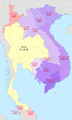
 Map of Siam and French Indochina.svg 748 × 1,243; 1,014 KB
-
 Map of Siam, Laos, Cambodia, and Shan States (1884).jpg 989 × 1,731; 734 KB
-
-
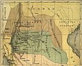
 Shan States map section-Shans at home.(1910).jpg 1,821 × 1,199; 260 KB
-
 Shan States-Map.png 1,332 × 1,534; 192 KB
-
 Shan-S-IGI.jpg 1,099 × 651; 206 KB
-
 Shan.png 1,281 × 1,500; 147 KB
-
 Siamese territorial concessions (1867-1909) with flags.gif 301 × 514; 32 KB
-
 Siamese territorial concessions (1867-1909).gif 301 × 514; 36 KB
-
 暹罗的领土丧失(1867-1909).png 300 × 730; 99 KB
_in_1530_km.png)
_in_1530.png)

_(14784320135).jpg)

.svg)
.png)

.jpg)
.jpg)
.jpg)


_with_flags.gif)
.gif)