Category:Maps of the South Bay
Media in category "Maps of the South Bay"
The following 14 files are in this category, out of 14 total.
-
 LA County Incorporated Areas Beach Cities highlighted.png 730 × 599; 246 KB
-
 Location map Southern Los Angeles.png 688 × 654; 554 KB
-
 CA-36th.png 755 × 440; 48 KB
-
 Gateway Cities in Southern California.png 464 × 332; 64 KB
-
 Lasouthbaybiketrail.gif 285 × 527; 46 KB
-
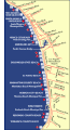
 Automobile road from Los Angeles to Redondo, 1921 (AAA-SM-005232).jpg 2,110 × 6,177; 3.06 MB
-
 South bay fr.png 1,183 × 1,109; 84 KB
-
 South Bay Los Angeles.png 1,183 × 1,109; 69 KB
-
 Southbay405.jpg 502 × 495; 30 KB
-
 LA County Incorporated Areas El Segundo highlighted.svg 950 × 780; 263 KB
-
 LA County Incorporated Areas Hermosa Beach highlighted.svg 950 × 780; 262 KB
-
 LA County Incorporated Areas Lomita highlighted.svg 950 × 780; 262 KB
-
 LA County Incorporated Areas Manhattan Beach highlighted.svg 950 × 780; 262 KB
-
 LA County Incorporated Areas Redondo Beach highlighted.svg 950 × 780; 261 KB


.jpg)