Category:Maps of the Southwestern United States
Media in category "Maps of the Southwestern United States"
The following 33 files are in this category, out of 33 total.
-
 Nearctic-Southwestern United States.svg 1,789 × 2,154; 378 KB
-
 Nearctic-Ecozone-Southwestern United States.svg 366 × 406; 21 KB
-
-
-
 1893 Poor's Mexican Central Railway.jpg 4,074 × 2,612; 1.71 MB
-
 7890510 orig.gif 563 × 370; 26 KB
-
 American-southwest-map.jpg 281 × 180; 11 KB
-
 Ancient-Regions.svg 929 × 1,008; 1.82 MB
-
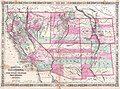
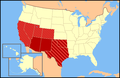
 Arizona, New Mexico and Texas.gif 880 × 680; 69 KB
-
 AZNMUT DST observance.png 5,007 × 5,400; 1.32 MB
-
 BlankMap-USA-Southwest-no-Utah.svg 410 × 346; 24 KB
-
 BlankMap-USA-states-southwest-UT.svg 563 × 552; 10 KB
-
 Borders of Four Corners, USA survey years.svg 240 × 250; 63 KB
-
 Butterfield-Overland (cropped).gif 915 × 1,018; 383 KB
-
 Butterfield-Overland.gif 2,509 × 1,021; 1.04 MB
-
 CSP prospects for the SW USA (3% slopes).jpg 1,583 × 1,211; 1.43 MB
-
 Hover Dam.png 1,000 × 1,004; 356 KB
-
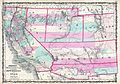
 LCASMapoftheSouthwest.jpg 700 × 535; 123 KB
-
 LLWS Southwest.svg 959 × 593; 98 KB
-
 Map-USA-Southwest01.png 1,286 × 1,062; 220 KB
-
 Map-USA-Southwest01.svg 744 × 1,052; 309 KB
-
 Mapa Mexico 1842.PNG 1,669 × 1,518; 113 KB
-
 Marcy Map 2.jpg 1,127 × 540; 379 KB
-
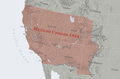 Mexican Cession.png 2,328 × 1,541; 2.81 MB
-
 Range Map.jpg 223 × 291; 17 KB
-
 Southwest map.png 1,280 × 832; 199 KB
-
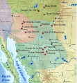
 Southwest.jpg 861 × 526; 29 KB
-
 Southwestern United States (Reed & Meinig).png 293 × 230; 19 KB
-

-

-
 US map-Southwest new.png 572 × 371; 23 KB
-
 US Southwest Temples Outline Map.svg 867 × 578; 10 KB
-
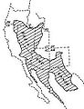
 Wpdms arizona new mexico territories 1863 idx.png 264 × 281; 14 KB


.gif)
.jpg)


.png)
.jpg)
_(14576024408).jpg)


