Category:Maps of the Spanish Armada
Media in category "Maps of the Spanish Armada"
The following 25 files are in this category, out of 25 total.
-
 Armadaroute.jpg 1,330 × 918; 608 KB
-
 DemonDeLuxe temp2.png 2,938 × 3,898; 1.99 MB
-
 DemonDeLuxe temp3.png 1,576 × 2,091; 570 KB
-
 Itsas Armada Garaiezina.png 363 × 903; 220 KB
-
 Kaarten van de Spaanse Armada (16 en 21 juli 1588), RP-P-1987-34-1.jpg 8,024 × 5,104; 6.79 MB
-
 Kaarten van de Spaanse Armada (21 en 22 juli 1588), RP-P-1987-34-2.jpg 7,554 × 4,811; 6.65 MB
-
 Kaarten van de Spaanse Armada (25 en 27 juli 1588), RP-P-1987-34-4.jpg 7,794 × 5,100; 6.62 MB
-
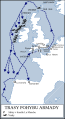
 Map to illustrate the Course of the Spanish Armada - Pg-79.jpg 535 × 1,015; 163 KB
-
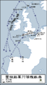
 Routes of the Spanish Armada (ca).svg 411 × 753; 78 KB
-
 Routes of the Spanish Armada (fr).PNG 415 × 756; 41 KB
-
 Routes of the Spanish Armada (fr).svg 411 × 753; 166 KB
-
 Routes of the Spanish Armada (it).svg 411 × 753; 169 KB
-
 Routes of the Spanish Armada (հայերեն - hy).png 415 × 756; 62 KB
-
 Routes of the Spanish Armada cs.svg 411 × 753; 168 KB
-
 Routes of the Spanish Armada HE.svg 411 × 753; 166 KB
-
 Routes of the Spanish Armada-es.svg 411 × 753; 172 KB
-
 Routes of the Spanish Armada-zh-classical.png 415 × 756; 22 KB
-
 Routes of the Spanish Armada.gif 415 × 756; 27 KB
-
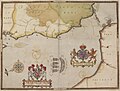
 The Armada Plates (BM 1888,1221.8.8).jpg 2,500 × 1,758; 924 KB
-
 The Armada Plates (BM 1888,1221.8.9).jpg 2,004 × 1,515; 757 KB
-
 The track of the Armada around Britain and Ireland RMG D3301.tiff 5,453 × 3,780; 58.97 MB
-
 The track of the Armada around Britain and Ireland RMG F8038.tiff 4,999 × 3,557; 50.87 MB
-
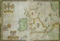
 The track of the Armada around Britain and Ireland RMG L8270.jpg 1,280 × 901; 613 KB
-
 Untergang der Armada.png 3,000 × 4,069; 3.99 MB
-
 Weg der Armada.gif 415 × 756; 82 KB


,_RP-P-1987-34-1.jpg)
,_RP-P-1987-34-2.jpg)
,_RP-P-1987-34-4.jpg)

.svg)
.PNG)
.svg)
.svg)
.png)


.jpg)
.jpg)


