Category:Maps of the State of Venezuela
Subcategories
This category has only the following subcategory.
M
Media in category "Maps of the State of Venezuela"
The following 7 files are in this category, out of 7 total.
-
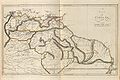 Map of venezuela(1760-1839).jpg 760 × 504; 76 KB
-
 Mapa politico de Venezuela 1840 restored version.jpg 6,161 × 4,279; 23.48 MB
-
 State of Venezuela (orthographic projection).png 1,024 × 1,024; 231 KB
-
 Venezuela (1840).svg 2,050 × 1,479; 729 KB
-
 Venezuela (1856).svg 2,050 × 1,479; 795 KB
-
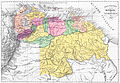
 Venezuela en 1810.jpg 1,539 × 1,066; 683 KB
-
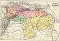
 Venezuela en 1840.jpg 1,526 × 1,074; 682 KB
.jpg)

.png)
.svg)
.svg)

