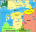
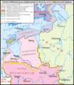
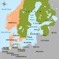
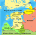
Category:Maps of the Swedish Empire (1561-1721)
Media in category "Maps of the Swedish Empire (1561-1721)"
The following 58 files are in this category, out of 58 total.
-
17cenBaltic.jpg 1,434 × 1,402; 1.07 MB
-
Swedish Empire 1658.jpg 1,476 × 1,809; 1.52 MB
-
Altfinnland-Danish version.png 519 × 544; 174 KB
-
Altfinnland-sv.png 519 × 544; 146 KB
-
Altfinnland.png 519 × 544; 144 KB
-
Baltic lands in 1661.jpg 1,716 × 2,243; 893 KB
-
Det svenske imperiet (1560-1815).svg 835 × 1,024; 144 KB
-
El Báltico superior bajo dominación sueca 1580-1721.png 934 × 842; 354 KB
-
Imperium Suecicum anno 1658.png 660 × 993; 374 KB
-
Karta över Svenska stormaktsväldet.png 2,000 × 2,453; 733 KB
-
Livon-war-post 1583.png 2,461 × 2,825; 157 KB
-
LocationSwedishEmpire.png 1,200 × 1,000; 29 KB
-
Map of the Holy League in 1595.svg 1,140 × 990; 525 KB
-
Mar Baltica - Expansion suedesa (sègles XVI-XVII).png 2,221 × 2,662; 911 KB
-
Nya Sverige.svg 720 × 1,260; 461 KB
-
NystatIngria.png 247 × 261; 7 KB
-
Ortus-imperii-suecorum-eo.jpg 1,519 × 1,929; 1,015 KB
-
Ortus-imperii-suecorum.png 1,519 × 1,929; 692 KB
-
PlanOfensivoDanés1657.svg 734 × 729; 614 KB
-
Puolustus 1657.png 1,178 × 1,451; 692 KB
-
Ruptuurisota.png 579 × 628; 75 KB
-
Scandinavia 1645-es.svg 1,191 × 1,799; 166 KB
-
Scandinavia 1658.gif 1,500 × 1,754; 51 KB
-
Sigismunds truppförflyttningar under Kriget mot Sigismund.gif 375 × 536; 122 KB
-
SueciaDeWestfalia1648.svg 734 × 729; 454 KB
-
Svenska Stormaktsväldet (1560 - 1815).svg 800 × 877; 508 KB
-
Sw BalticProv en.png 922 × 829; 624 KB
-
Sw BalticProv fr.png 922 × 901; 94 KB
-
Sw BalticProv hu.svg 1,229 × 1,105; 775 KB
-
Sw BalticProv ka.png 922 × 829; 396 KB
-
Sw BalticProv ru.png 922 × 829; 458 KB
-
Sw BalticProv sv.png 922 × 829; 328 KB
-
Sweden 1658.jpg 1,332 × 960; 292 KB
-
Sweden 1658.png 465 × 700; 10 KB
-
Sweden in 1658-es.svg 1,191 × 1,799; 174 KB
-
Sweden in 1658.PNG 398 × 599; 63 KB
-
Sweden2.gif 398 × 599; 66 KB
-
Swedish Bremen-Verden.svg 1,800 × 1,800; 305 KB
-
Swedish Empire (1560-1815) blank.svg 433 × 531; 106 KB
-
Swedish Empire (1560-1815) en1.png 1,802 × 2,213; 370 KB
-
Swedish Empire (1560-1815) en2.png 1,802 × 2,213; 350 KB
-
Swedish Empire (1560-1815) es.svg 734 × 729; 728 KB
-
Swedish Empire (1560-1815) fr.svg 433 × 531; 246 KB
-
Swedish Empire (1560-1815) nl.png 1,519 × 1,929; 527 KB
-
Swedish Empire (1658).png 948 × 996; 32 KB
-
Swedish Empire in Early Modern Europe (1560-1815)-sv unfinished.svg 433 × 531; 143 KB
-
Swedish Empire in the Baltic (1560-1721).png 300 × 209; 38 KB
-
Swedish Empire Map-es.svg 1,456 × 1,678; 253 KB
-
Swedish Empire Map-hu.svg 1,456 × 1,678; 192 KB
-
Swedish Empire.png 1,425 × 625; 32 KB
-
Swedish Pomerania 1812.png 490 × 372; 490 KB
-
Swedish territories in 1658.png 465 × 700; 8 KB
-
Swedish Wismar map.svg 1,000 × 1,000; 154 KB
-
Swedish–Lithuanian Union (1655–1657).png 2,000 × 2,027; 535 KB
-
The height of Swedish territories in 1658.svg 1,191 × 1,799; 161 KB
-
TratadoDeRoskilde hu.svg 734 × 729; 301 KB
-
TratadoDeRoskilde.svg 734 × 729; 446 KB
-
Карта разграничения по Ништадтскому договору, 1722.jpg 1,600 × 1,389; 420 KB


