Category:Maps of the Tigray War
Media in category "Maps of the Tigray War"
The following 39 files are in this category, out of 39 total.
-
 2020 Tigray Conflict.svg 2,859 × 2,184; 20.26 MB
-

-
 Addis Ababa Offensive (October - November 2021).svg 900 × 835; 1.14 MB
-

-
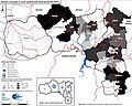
 Approximate territorial control on 23 April 2021.jpg 767 × 612; 215 KB
-

-
 Dedebit airstrike.svg 728 × 674; 504 KB
-
 Dispatched versus distributed food aid (31-05-2021).jpg 769 × 613; 189 KB
-

-
 Ethiopia overall conflcit map 2020s.png 2,055 × 1,471; 2.25 MB
-
 Ethiopian Civil War (2020-present).svg 1,843 × 1,494; 1.1 MB
-
 Food distribution partners in Tigray on 31 May 2021.jpg 556 × 406; 60 KB
-
 Gondar-Bahir Dar Offensive (July - August 2021).svg 900 × 565; 1.08 MB
-

-

-

-
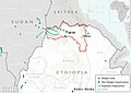
 Location of Tigray Defense Forces.png 209 × 234; 31 KB
-
-
 National Unity Offensive (November - December 2021).svg 900 × 835; 1.15 MB
-

-
 Number of people in need reached with food aid (31-05-2021).jpg 767 × 616; 181 KB
-
 Number of people in need reached with food aid (31-05-2021).png 1,843 × 1,478; 1.77 MB
-

-
 Population displacement due to Tigray conflict (cropped).jpg 949 × 675; 91 KB
-
 Population displacement due to Tigray conflict.jpg 994 × 768; 102 KB
-

-

-
 Restricted humanitarian access due to the ongoing conflict (31-07-2021).png 1,865 × 1,502; 2.17 MB
-

-
 Territorial control on 6-7-2021.jpg 769 × 614; 217 KB
-
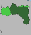
 Tigray Insurgency (November 2020 - June 2021).svg 700 × 530; 1.14 MB
-
 Tigray Offensive (November 2020).svg 700 × 530; 1.06 MB
-
 Tigray Offensive (September - November 2022).svg 700 × 530; 720 KB
-
 Tigray War as of April 2021.jpg 1,224 × 900; 165 KB
-
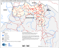
 Tigray War reported conflict incidents - November 2020 to December 2021.png 1,833 × 1,480; 524 KB
-
 Tigray War territory July 2021.png 1,964 × 1,127; 433 KB
-
 Tigray War territory July 2021.svg 1,400 × 933; 788 KB
-
 Tigray War test map.png 1,250 × 1,080; 74 KB
-
 Tigrayconflict.png 1,116 × 799; 162 KB


.svg)
.jpg)

_and_projected_(July-September_2021)_food_security_outcomes_in_Tigray.jpg)

.jpg)
_due_to_the_Tigray_War_at_the_end_of_August_2021.png)

.svg)

.svg)


_and_sites_visited_by_the_joint_EHRC-UNHRC_investigation.png)
.svg)
._Note_that_this_map_does_not_take_into_account_internal_migration_due_to_the_Tigray_war_(!)_%E2%80%93_see_Map_16_for_this_information.jpg)
.jpg)
.png)
.jpg)
.jpg)

.jpg)
.jpg)
.png)
_due_to_the_Tigray_War._The_zone_of_origin_of_the_IDPs_is_indicated_within_the_pie_charts._The_number_of_IDPs_in_%E2%80%9Chard-to-reach%E2%80%9D_areas_remain_unknown.jpg)

.svg)
.svg)
.svg)


